IMAGES TAKEN NEAR TO
Whitfield, HEXHAM, NE47 8HA
Introduction
This page details the photographs taken nearby to NE47 8HA by members of the Geograph project.
The Geograph project started in 2005 with the aim of publishing, organising and preserving representative images for every square kilometre of Great Britain, Ireland and the Isle of Man.

There are currently over 7.5m images from over14,400 individuals and you can help contribute to the project by visiting https://www.geograph.org.uk
Image Map
Images are licensed for reuse under creativecommons.org/licenses/by-sa/2.0
Notes
- Clicking on the map will re-center to the selected point.
- The higher the marker number, the further away the image location is from the centre of the postcode.
Image Listing (33 Images Found)
Images are licensed for reuse under creativecommons.org/licenses/by-sa/2.0
Image
Details
Distance
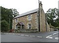
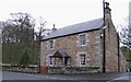
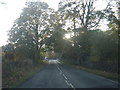
2
Whitfield
Taken looking west from the minor road to Allendale below Harlowbank.
Image: © Mike Quinn
Taken: 25 Apr 2007
0.03 miles
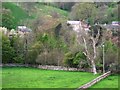
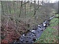
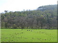
3
Pastures and woodland near the River West Allen at Whitfield (2)
Image: © Mike Quinn
Taken: 20 Apr 2009
0.04 miles
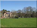
8
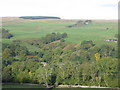
West Allen Dale around Whitfield
Looking across the valley towards Old Dyke Row (half right) in the northwest corner of Image and Cockerhill Plantation (on the horizon half left) in the northwest corner of Image
Image: © Mike Quinn
Taken: 7 Oct 2010
0.06 miles
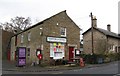
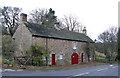
10
Pastures and woodland near the River West Allen at Whitfield
Image: © Mike Quinn
Taken: 20 Apr 2009
0.09 miles