IMAGES TAKEN NEAR TO
Mohope, HEXHAM, NE47 8DH
Introduction
This page details the photographs taken nearby to NE47 8DH by members of the Geograph project.
The Geograph project started in 2005 with the aim of publishing, organising and preserving representative images for every square kilometre of Great Britain, Ireland and the Isle of Man.

There are currently over 7.5m images from over14,400 individuals and you can help contribute to the project by visiting https://www.geograph.org.uk
Image Map
Images are licensed for reuse under creativecommons.org/licenses/by-sa/2.0
Notes
- Clicking on the map will re-center to the selected point.
- The higher the marker number, the further away the image location is from the centre of the postcode.
Image Listing (36 Images Found)
Images are licensed for reuse under creativecommons.org/licenses/by-sa/2.0
Image
Details
Distance
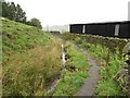
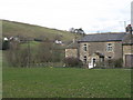
3
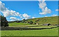
The Mo Hope valley
A tributary of the River West Allen.
Image: © Oliver Dixon
Taken: 20 Feb 2015
0.07 miles
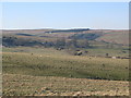
6
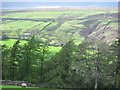
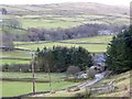
Mo Hope valley
The steep cleugh south of Fairplay in Image can be seen on the opposite side of the valley.
Image: © Mike Quinn
Taken: 25 Apr 2007
0.09 miles
7
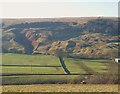
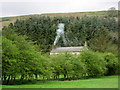
Disused lead mine workings in the Mo Hope Valley
Image: © Mike Quinn
Taken: 16 Feb 2008
0.10 miles
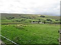
10
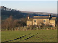
Mo Hope valley (3)
Photo taken from the minor road near Dale House in the southwest corner of Image
Image: © Mike Quinn
Taken: 16 Feb 2008
0.12 miles