IMAGES TAKEN NEAR TO
Carrshield, HEXHAM, NE47 8AW
Introduction
This page details the photographs taken nearby to NE47 8AW by members of the Geograph project.
The Geograph project started in 2005 with the aim of publishing, organising and preserving representative images for every square kilometre of Great Britain, Ireland and the Isle of Man.

There are currently over 7.5m images from over14,400 individuals and you can help contribute to the project by visiting https://www.geograph.org.uk
Image Map
Images are licensed for reuse under creativecommons.org/licenses/by-sa/2.0
Notes
- Clicking on the map will re-center to the selected point.
- The higher the marker number, the further away the image location is from the centre of the postcode.
Image Listing (19 Images Found)
Images are licensed for reuse under creativecommons.org/licenses/by-sa/2.0
Image
Details
Distance
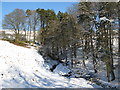
3
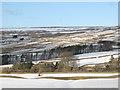
West Allen Dale north of Whiteley Shield (2)
Image: © Mike Quinn
Taken: 14 Mar 2011
0.09 miles
4
West Allen Dale north of Whiteley Shield
Image: © Mike Quinn
Taken: 14 Mar 2011
0.10 miles
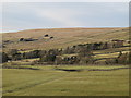
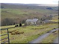
5
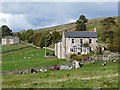
South View and Hartleycleugh
Two houses (South View is the nearer) beside the road which climbs out of West Allendale over the moors to Allendale Town.
Image: © Oliver Dixon
Taken: 30 Sep 2010
0.12 miles
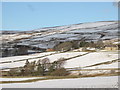
6
West Allen Dale - Low Hartleycleugh and High Turney Shield
Image: © Mike Quinn
Taken: 10 Feb 2010
0.12 miles
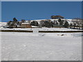
8
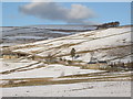
Snowy pastures around High Turney Shield
Photo taken from the minor road to Ninebanks in Image
Image: © Mike Quinn
Taken: 2 Mar 2010
0.15 miles
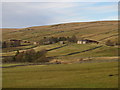
10
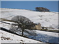
High Turney Shield Farm
On the hillside above West Allendale, complete with wind turbine.
Image: © Oliver Dixon
Taken: 20 Feb 2015
0.16 miles