IMAGES TAKEN NEAR TO
Bardon Mill, HEXHAM, NE47 7AF
Introduction
This page details the photographs taken nearby to NE47 7AF by members of the Geograph project.
The Geograph project started in 2005 with the aim of publishing, organising and preserving representative images for every square kilometre of Great Britain, Ireland and the Isle of Man.

There are currently over 7.5m images from over14,400 individuals and you can help contribute to the project by visiting https://www.geograph.org.uk
Image Map
Images are licensed for reuse under creativecommons.org/licenses/by-sa/2.0
Notes
- Clicking on the map will re-center to the selected point.
- The higher the marker number, the further away the image location is from the centre of the postcode.
Image Listing (13 Images Found)
Images are licensed for reuse under creativecommons.org/licenses/by-sa/2.0
Image
Details
Distance
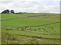
1
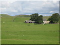
East Crindledykes Farm
The farm road is also a bridleway leading from Stanegate through to the Military Road.
Image: © Oliver Dixon
Taken: 24 Jun 2013
0.01 miles
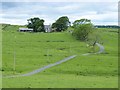
3

East Crindledykes
East Crindledykes Farm.
Image: © Peter McDermott
Taken: 8 Aug 2009
0.03 miles
4
Green Brae, East Crindledykes
A craggy little limestone ridge crossed by the bridleway. The Romans may have quarried the outcrops to produce mortar - they did have a few building projects near here.
Image: © Karl and Ali
Taken: 27 Jun 2010
0.17 miles
5
Farmland around East Crindledykes
Photo taken from The Stanegate in Image
Image: © Mike Quinn
Taken: 25 Aug 2010
0.21 miles
6
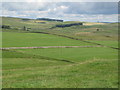
Farmland between Morwood and East Crindledykes
Photo taken from The Stanegate in Image
Image: © Mike Quinn
Taken: 25 Aug 2010
0.21 miles
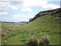
7
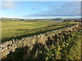
Small rock outcrop and hill north of Grandy's Knowe
Image: © Mike Quinn
Taken: 30 Jul 2009
0.22 miles
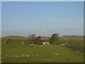
8
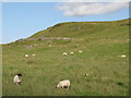
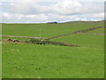
Grazing Land between East Crindledykes and West Morwood
Image: © Clive Nicholson
Taken: 1 Dec 2013
0.23 miles
9
Farmland between Morwood and East Crindledykes
Image: © Mike Quinn
Taken: 25 Aug 2010
0.23 miles