IMAGES TAKEN NEAR TO
Bardon Mill, HEXHAM, NE47 7AB
Introduction
This page details the photographs taken nearby to NE47 7AB by members of the Geograph project.
The Geograph project started in 2005 with the aim of publishing, organising and preserving representative images for every square kilometre of Great Britain, Ireland and the Isle of Man.

There are currently over 7.5m images from over14,400 individuals and you can help contribute to the project by visiting https://www.geograph.org.uk
Image Map
Images are licensed for reuse under creativecommons.org/licenses/by-sa/2.0
Notes
- Clicking on the map will re-center to the selected point.
- The higher the marker number, the further away the image location is from the centre of the postcode.
Image Listing (12 Images Found)
Images are licensed for reuse under creativecommons.org/licenses/by-sa/2.0
Image
Details
Distance
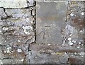
1
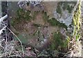
Ordnance Survey Cut Mark
This OS cut mark can be found on the gatepost SE side of the road. It marks a point 127.025m above mean sea level.
Image: © Adrian Dust
Taken: 8 Feb 2020
0.08 miles
2
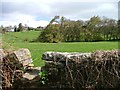
Stile, Bardon Mill
A close call this. The start of the Public Footpath is mapped as on the easting. This is looking NW towards West End Town.
Image: © Mick Garratt
Taken: 29 Apr 2006
0.09 miles
3
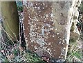
Ordnance Survey Cut Mark
This OS cut mark can be found on the gatepost NE side of the road junction. It marks a point 106.372m above mean sea level.
Image: © Adrian Dust
Taken: 8 Feb 2020
0.10 miles
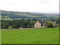
4
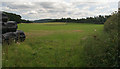
Bardon Mill
Fields above Bardon Mill.
Image: © Peter McDermott
Taken: 8 Aug 2009
0.14 miles
5
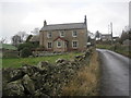
The Hott (For Sale)
Possibly a former farmhouse
Image: © Les Hull
Taken: 19 Feb 2014
0.18 miles
7
Ordnance Survey Cut Mark
This OS cut mark can be found on The Hott. It marks a point 148.916m above mean sea level.
Image: © Adrian Dust
Taken: 8 Feb 2020
0.19 miles
8
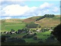
West End Town
On the horizon (far right, to the right of the trees) it's just possible to see Image Photo taken from the upper path at Allen Banks in Image
Image: © Mike Quinn
Taken: 8 Sep 2013
0.24 miles
9
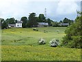
West End Town
Seen across a field of buttercups.
Image: © Oliver Dixon
Taken: 15 Jun 2013
0.24 miles
10
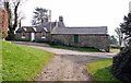
Cottage & outbuilding by The White House, West End Town
Image: © Andrew Curtis
Taken: 24 Mar 2012
0.24 miles