IMAGES TAKEN NEAR TO
Steel, HEXHAM, NE47 0JG
Introduction
This page details the photographs taken nearby to NE47 0JG by members of the Geograph project.
The Geograph project started in 2005 with the aim of publishing, organising and preserving representative images for every square kilometre of Great Britain, Ireland and the Isle of Man.

There are currently over 7.5m images from over14,400 individuals and you can help contribute to the project by visiting https://www.geograph.org.uk
Image Map
Images are licensed for reuse under creativecommons.org/licenses/by-sa/2.0
Notes
- Clicking on the map will re-center to the selected point.
- The higher the marker number, the further away the image location is from the centre of the postcode.
Image Listing (118 Images Found)
Images are licensed for reuse under creativecommons.org/licenses/by-sa/2.0
Image
Details
Distance
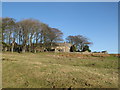
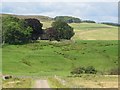
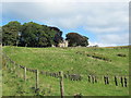
3
Harwood Shield Farm (5)
In high summer, the farmhouse is almost invisible - see Image
Image: © Mike Quinn
Taken: 10 Feb 2008
0.01 miles
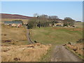
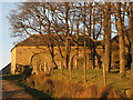
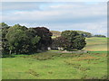
4
Harwoodshield Farm (3)
In the foreground is Image, on which is Image; Image can be seen behind the wooden fence in the foreground on the right.
Image: © Mike Quinn
Taken: 10 Feb 2008
0.02 miles
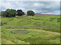
9
Over 200 moles on a wire below Harwood Shield
See also Image
Image: © Mike Quinn
Taken: 8 Sep 2012
0.02 miles
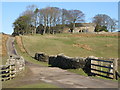
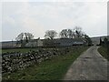
10
Harwood Shield Farm (5)
For a similar view in May (2008) see Image
Image: © Mike Quinn
Taken: 8 Sep 2012
0.02 miles