IMAGES TAKEN NEAR TO
Steel, HEXHAM, NE47 0HX
Introduction
This page details the photographs taken nearby to NE47 0HX by members of the Geograph project.
The Geograph project started in 2005 with the aim of publishing, organising and preserving representative images for every square kilometre of Great Britain, Ireland and the Isle of Man.

There are currently over 7.5m images from over14,400 individuals and you can help contribute to the project by visiting https://www.geograph.org.uk
Image Map
Images are licensed for reuse under creativecommons.org/licenses/by-sa/2.0
Notes
- Clicking on the map will re-center to the selected point.
- The higher the marker number, the further away the image location is from the centre of the postcode.
Image Listing (14 Images Found)
Images are licensed for reuse under creativecommons.org/licenses/by-sa/2.0
Image
Details
Distance
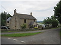
4
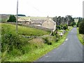
Lilswood Cottage
Beside the road running down the valley of the Devil's Water.
Image: © Oliver Dixon
Taken: 13 Jul 2008
0.11 miles
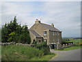
6
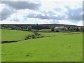
Pastures around Broadwell Sike
Looking towards the "cross" plantation in the southwest corner of the grid square - see the satellite image http://openspace.nearby.org.uk/wheresthepath.htm?lat=54.874455886369894&lon=-2.1381398356581025&gz=16&oz=8>=1.
Image: © Mike Quinn
Taken: 9 Aug 2011
0.14 miles
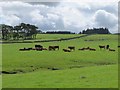
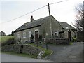
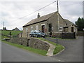
8
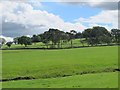
Pastures and woodland around Broadwell Sike
Image: © Mike Quinn
Taken: 9 Aug 2011
0.16 miles
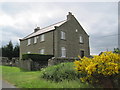
9
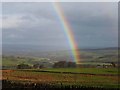
Rainbow over Hexhamshire
Looking down the valley of the Devil's Water.
Image: © Oliver Dixon
Taken: 2 Jan 2014
0.16 miles