IMAGES TAKEN NEAR TO
Reaston View, HEXHAM, NE47 0BD
Introduction
This page details the photographs taken nearby to Reaston View, NE47 0BD by members of the Geograph project.
The Geograph project started in 2005 with the aim of publishing, organising and preserving representative images for every square kilometre of Great Britain, Ireland and the Isle of Man.

There are currently over 7.5m images from over14,400 individuals and you can help contribute to the project by visiting https://www.geograph.org.uk
Image Map
Images are licensed for reuse under creativecommons.org/licenses/by-sa/2.0
Notes
- Clicking on the map will re-center to the selected point.
- The higher the marker number, the further away the image location is from the centre of the postcode.
Image Listing (9 Images Found)
Images are licensed for reuse under creativecommons.org/licenses/by-sa/2.0
Image
Details
Distance
3
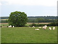
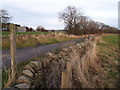
Slaley
Fields at the east end of Slaley Village.
Image: © Peter McDermott
Taken: 29 Aug 2009
0.11 miles
4
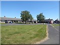
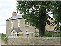
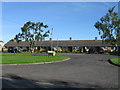
Park Side, Slaley
Appear to be old miner's cottages, much upgraded.
Image: © Oliver Dixon
Taken: 31 May 2020
0.14 miles
8
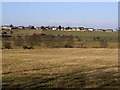
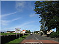
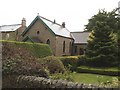
Slaley village
The village stands on a low ridge above the surrounding area. Seen from the Lead Road to the south.
Image: © Oliver Dixon
Taken: 17 Jan 2009
0.24 miles