
IMAGES TAKEN NEAR TO
Lynnwood Avenue, NEWCASTLE UPON TYNE, NE4 6XB
Introduction
This page details the photographs taken nearby to Lynnwood Avenue, NE4 6XB by members of the Geograph project.
The Geograph project started in 2005 with the aim of publishing, organising and preserving representative images for every square kilometre of Great Britain, Ireland and the Isle of Man.

There are currently over 7.5m images from over14,400 individuals and you can help contribute to the project by visiting https://www.geograph.org.uk
Image Map
Images are licensed for reuse under creativecommons.org/licenses/by-sa/2.0
Notes
- Clicking on the map will re-center to the selected point.
- The higher the marker number, the further away the image location is from the centre of the postcode.
Image Listing (105 Images Found)
Images are licensed for reuse under creativecommons.org/licenses/by-sa/2.0
Image
Details
Distance
1
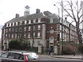
Angel Heights
Formerly the Wingrove Hospital Nurses Home
Image: © Anthony Foster
Taken: 4 Apr 2009
0.01 miles
2
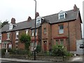
Jubilee Cottage, Bentinck Road
The cottage contains a plaque celebrating Queen Victoria's Diamond Jubilee - see Image The plaques were manufactured by Stanley Bros of Nuneaton, and were designed for use on any building erected from June 1897 to the end of the Jubilee year.
Image: © Anthony Foster
Taken: 6 Sep 2016
0.02 miles
3
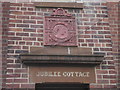
Diamond Jubilee Plaque, Jubilee Cottage, Bentinck Road
This plaque celebrating Queen Victoria's Diamond Jubilee can be found on Jubilee Cottage in Newcastle's West End - see Image The plaques were manufactured by Stanley Bros of Nuneaton, and were designed for use on any building erected from June 1897 to the end of the Jubilee year.
Image: © Anthony Foster
Taken: 6 Sep 2016
0.02 miles
4
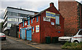
Arthur's Hill Garage
Arthur's Hill Garage behind the police station at Arthur's Hill.
Image: © Peter McDermott
Taken: 26 Jun 2011
0.03 miles
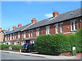
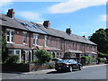
7
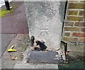
Ordnance Survey Cut Mark
This OS cut mark can be found on the wall post of No1 Bentinck Villas. It marks a point 107.838m above mean sea level.
Image: © Adrian Dust
Taken: 21 Sep 2024
0.04 miles
8
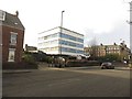
Former police station, Westgate Road, Newcastle upon Tyne
The site of a former police station on the south side of Westgate Road is now up for sale. Neighbourhood policing teams are now located in the college on the opposite side of the road.
Image: © Graham Robson
Taken: 6 Dec 2017
0.05 miles
9
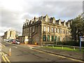
Disused building, Campus for Ageing and Vitality, Newcastle upon Tyne
One of several disused building on the former Newcastle General Hospital site on Westgate Road. The services from the hospital were moved to the Freeman and Royal Victoria Infirmary hospitals in the city and the site was rechristened as the Campus for Ageing and Vitality. In its new guise a number of the former hospital buildings are standing vacant.
Image: © Graham Robson
Taken: 6 Dec 2017
0.06 miles
10
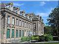
(Part of) Newcastle University Campus for Ageing and Vitality, Westgate Road, NE4
Image: © Mike Quinn
Taken: 30 Aug 2016
0.07 miles