
IMAGES TAKEN NEAR TO
Northbourne Street, NEWCASTLE UPON TYNE, NE4 6TA
Introduction
This page details the photographs taken nearby to Northbourne Street, NE4 6TA by members of the Geograph project.
The Geograph project started in 2005 with the aim of publishing, organising and preserving representative images for every square kilometre of Great Britain, Ireland and the Isle of Man.

There are currently over 7.5m images from over14,400 individuals and you can help contribute to the project by visiting https://www.geograph.org.uk
Image Map
Images are licensed for reuse under creativecommons.org/licenses/by-sa/2.0
Notes
- Clicking on the map will re-center to the selected point.
- The higher the marker number, the further away the image location is from the centre of the postcode.
Image Listing (26 Images Found)
Images are licensed for reuse under creativecommons.org/licenses/by-sa/2.0
Image
Details
Distance
1
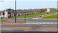
James Street, Elswick
Nearer the camera, the terraced Tyneside flats along Northbourne Street have long gone. West View is the street behind James Street Image
Image: © Andrew Curtis
Taken: 23 Mar 2012
0.06 miles
2
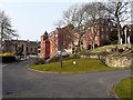
St Joseph's Home, Westmorland Road
A care home run by Little Sisters of the Poor who have had a presence in Newcastle since 1866. The chapel can be seen on the left.
Image: © Andrew Curtis
Taken: 23 Mar 2012
0.07 miles
3
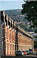
West View
Looking down West View in Elswick.
Image: © Peter McDermott
Taken: 24 Jul 2011
0.07 miles
4
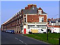
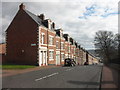
West View, Elswick
View from the south end of the street. The view down is shown here Image
Most of the terrace is made up of typical Tyneside Flats. Each terraced house consists of a purpose built pair of flats, one above the other. Each flat has its own separate front door opening directly onto the street. The doors to the lower and upper flats are normally adjacent. Both flats have their own access to the rear yard, the upper flat via a flight of external steps. In West View the size of upper flats was increased by building into the attics.
https://theses.ncl.ac.uk/dspace/bitstream/10443/1096/1/Wadsworth%2011.pdf
The streets were laid out in a gridiron pattern, often up-slope rather than following the contour. The houses here were built in the 1880s to provide homes for the workers in Armstrong's armaments factory on Scotswood Road.
http://www.timarchive2.freeuk.com/html/elswick.htm
Image: © Andrew Curtis
Taken: 23 Mar 2012
0.08 miles
6
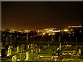
Elswick Cemetery
Looking south across the cemetery towards Gateshead.
Image: © Stephen Sweeney
Taken: 12 Jan 2009
0.13 miles
7
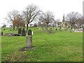
Graves in St John's Cemetery, Elswick, Newcastle upon Tyne
The south east corner of St John's Cemetery in Elswick.
Image: © Graham Robson
Taken: 6 Dec 2017
0.13 miles
8
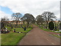
St John's Cemetery, Elswick
Listed Grade II there is a detailed description of the cemetery on Historic England's list entry https://www.historicengland.org.uk/listing/the-list/list-entry/1000761
Image: © Anthony Foster
Taken: 17 Apr 2016
0.16 miles
9
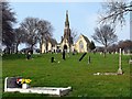
St John's Cemetery, Elswick
Chapels and archway, c1856, designed by Johnstone and Knowles. A Grade II Listed Building https://historicengland.org.uk/listing/the-list/list-entry/1024893
Image: © Andrew Curtis
Taken: 23 Mar 2012
0.16 miles
10
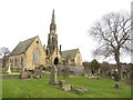
Chapels in St John's Cemetery, Elswick, Newcastle upon Tyne
The pair of chapels located in the middle of St John's Cemetery, Elswick. The chapels are in a dilapidated state with the entrance and space under the central arch fenced off. The chapels are grade II listed (link: http://historicengland.org.uk/listing/the-list/list-entry/1024893).
Image: © Graham Robson
Taken: 6 Dec 2017
0.17 miles