
IMAGES TAKEN NEAR TO
Marie Curie Drive, NEWCASTLE UPON TYNE, NE4 6SS
Introduction
This page details the photographs taken nearby to Marie Curie Drive, NE4 6SS by members of the Geograph project.
The Geograph project started in 2005 with the aim of publishing, organising and preserving representative images for every square kilometre of Great Britain, Ireland and the Isle of Man.

There are currently over 7.5m images from over14,400 individuals and you can help contribute to the project by visiting https://www.geograph.org.uk
Image Map
Images are licensed for reuse under creativecommons.org/licenses/by-sa/2.0
Notes
- Clicking on the map will re-center to the selected point.
- The higher the marker number, the further away the image location is from the centre of the postcode.
Image Listing (21 Images Found)
Images are licensed for reuse under creativecommons.org/licenses/by-sa/2.0
Image
Details
Distance
1
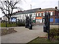
Entrance to Elswick Park on Elswick Road
The ornamental gates were specially commissioned for a recent revamp of the park. They are by Northumberland artist, William Pym and incorporate wrought iron baskets containing colourful glass baubles.
Image: © Andrew Curtis
Taken: 11 Mar 2010
0.08 miles
2
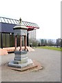
Elswick Park Drinking Fountain
Erected in 1881 to commemorate the role of six Newcastle men who secured Elswick Park until the Corporation bought it for use by the public. Inscribed with the words: "THEY SAVED THIS PARK/ FOR PUBLIC USE/ FOR HEALTH BEAUTY/ AND HAPPINESS/ TO ELEVATE MAN/ AND HONOUR GOD" and "JOS COWEN/ THOS FOSTER/ THOS GRAY/ THOS HODGKIN/ WM SMITH/ WM H STEPHENSON" and "ERECTED BY PUBLIC SUBSCRIPTION 1881".
Tyne and Wear HER (10318): Elswick Park, drinking fountain http://www.twsitelines.info
Image: © Andrew Curtis
Taken: 11 Mar 2010
0.13 miles
3
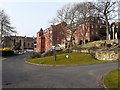
St Joseph's Home, Westmorland Road
A care home run by Little Sisters of the Poor who have had a presence in Newcastle since 1866. The chapel can be seen on the left.
Image: © Andrew Curtis
Taken: 23 Mar 2012
0.14 miles
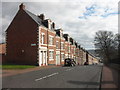
5
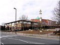
Newcastle Mosque & Islamic Centre from Elswick Road
Entrance is on Malvern Street.
Image: © Andrew Curtis
Taken: 11 Mar 2010
0.15 miles
6
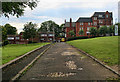
Elswick Road
Looking along Elswick Road (back) towards Beech Grove Road.
Image: © Peter McDermott
Taken: 26 Jun 2011
0.16 miles
7
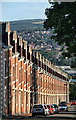
West View
Looking down West View in Elswick.
Image: © Peter McDermott
Taken: 24 Jul 2011
0.17 miles
8
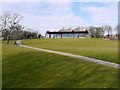
Elswick Park & Pool
Looking up from the Westmorland Road end of the park towards the sports centre and swimming pool which re-opened on 1st October 2009 after a £1.1 million refurbishment.
Elswick Park was opened to the public in 1881. Elswick Hall, built in 1803, had been abandoned due to rising costs and was eventually demolished about 1980, its site used for the Pool. Tomlinson said that this park had much larger and older trees than Leazes Park. It had a lake, bowling green, rockery, a terrace in front of the aviaries, with a fine granite drinking fountain Image
Tyne and Wear HER (5256): Elswick Park http://www.twsitelines.info
Image: © Andrew Curtis
Taken: 11 Mar 2010
0.17 miles
9
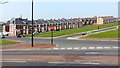
James Street, Elswick
Nearer the camera, the terraced Tyneside flats along Northbourne Street have long gone. West View is the street behind James Street Image
Image: © Andrew Curtis
Taken: 23 Mar 2012
0.18 miles
10
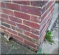
Ordnance Survey Cut Mark
This OS cut mark can be found on No102 Durham Street. It marks a point 97.865m above mean sea level.
Image: © Adrian Dust
Taken: 21 Sep 2024
0.18 miles