IMAGES TAKEN NEAR TO
Kingsley Terrace, NEWCASTLE UPON TYNE, NE4 6PL
Introduction
This page details the photographs taken nearby to Kingsley Terrace, NE4 6PL by members of the Geograph project.
The Geograph project started in 2005 with the aim of publishing, organising and preserving representative images for every square kilometre of Great Britain, Ireland and the Isle of Man.

There are currently over 7.5m images from over14,400 individuals and you can help contribute to the project by visiting https://www.geograph.org.uk
Image Map
Images are licensed for reuse under creativecommons.org/licenses/by-sa/2.0
Notes
- Clicking on the map will re-center to the selected point.
- The higher the marker number, the further away the image location is from the centre of the postcode.
Image Listing (84 Images Found)
Images are licensed for reuse under creativecommons.org/licenses/by-sa/2.0
Image
Details
Distance
1
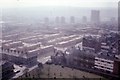
Mixed Housing Elswick Newcastle upon Tyne
From the top of Image] Mixed types of houses replacing older "industrial revolution time" houses post WW2.
Image: © N T Stobbs
Taken: Unknown
0.02 miles

4
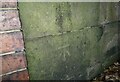
Ordnance Survey Cut Mark
This OS cut mark can be found on the wall of the school on Westgate Road. It marks a point 103.949m above mean sea level.
Image: © Adrian Dust
Taken: 21 Sep 2024
0.11 miles
5
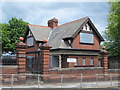
Lodge to Westgate Hill School, Westgate Road, NE4
The lodge, along with its wall, piers, gateposts and gates, is Grade II listed https://www.historicengland.org.uk/listing/the-list/list-entry/1024737 .
Image: © Mike Quinn
Taken: 30 Jun 2016
0.12 miles
6
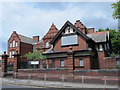
Westgate Hill School and Lodge, Westgate Road, NE4
Both are Grade II listed: https://www.historicengland.org.uk/listing/the-list/list-entry/1355331 and https://www.historicengland.org.uk/listing/the-list/list-entry/1024737 .
Image: © Mike Quinn
Taken: 30 Jun 2016
0.12 miles
7
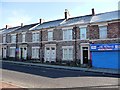
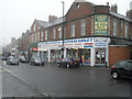
Maisonettes in Beaconsfield Road
You can tell they are purpose-built maisonettes, because each downstairs front window is separated by two front doors, one for the upstairs flat and one for downstairs.
The shop sells fish, and advertises itself in Bengali as well as English.
Image: © Christine Johnstone
Taken: 4 Mar 2010
0.12 miles
8
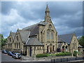
Westgate Hill Baptist Church, Westgate Road, NE4
The church is Grade II listed https://www.historicengland.org.uk/listing/the-list/list-entry/1121968 .
Image: © Mike Quinn
Taken: 30 Jun 2016
0.12 miles
9
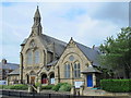
Westgate Hill Baptist Church, Westgate Road, NE4 (2)
The church is Grade II listed https://www.historicengland.org.uk/listing/the-list/list-entry/1121968 .
Image: © Mike Quinn
Taken: 30 Jun 2016
0.13 miles