
IMAGES TAKEN NEAR TO
Anglesey Place, NEWCASTLE UPON TYNE, NE4 6JF
Introduction
This page details the photographs taken nearby to Anglesey Place, NE4 6JF by members of the Geograph project.
The Geograph project started in 2005 with the aim of publishing, organising and preserving representative images for every square kilometre of Great Britain, Ireland and the Isle of Man.

There are currently over 7.5m images from over14,400 individuals and you can help contribute to the project by visiting https://www.geograph.org.uk
Image Map
Images are licensed for reuse under creativecommons.org/licenses/by-sa/2.0
Notes
- Clicking on the map will re-center to the selected point.
- The higher the marker number, the further away the image location is from the centre of the postcode.
Image Listing (231 Images Found)
Images are licensed for reuse under creativecommons.org/licenses/by-sa/2.0
Image
Details
Distance
1

Quarry Bank Court
Quarry Bank Court with Westgate Court and Todds Nook in the background.
Image: © Peter McDermott
Taken: 1 May 2011
0.05 miles
2
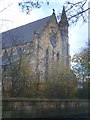
Former St. Paul's Church, Elswick
The church was at the foot of Cromwell Street
Image: © Anthony Foster
Taken: 25 Nov 2006
0.05 miles
3
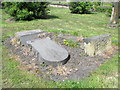
Clennell Family tomb in Westgate Hill Cemetery
The tomb is Grade II listed https://www.historicengland.org.uk/listing/the-list/list-entry/1338567 . For the obvious reason, I cannot be absolutely certain that this is the tomb - but it fits the description in the text of the listing "Headstone. Circa 1854. Signed Pearson of Gibson Street. Sandstone ashlar. Round-topped moulded slab commemorating John and Elizabeth Clennell of St. Peter's Quay died 1854 and 56, their son Luke and members of the Clennell family to 1938"; and the location was that given in the listing. Luke Clennell was one of the best of a vigorous school of Newcastle painters https://en.wikipedia.org/wiki/Luke_Clennell .
Image: © Mike Quinn
Taken: 5 May 2016
0.06 miles
4
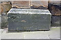
Benchmark on Westgate Hill cemetery wall pier
Ordnance Survey cut mark benchmark described on the Bench Mark Database at http://www.bench-marks.org.uk/bm43173
Image: © Roger Templeman
Taken: 21 May 2012
0.07 miles
5
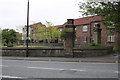
Wall at western end of Westgate Hill Cemetery
There is an OS benchmark Image on the base of the wall pier in the middle of the image
Image: © Roger Templeman
Taken: 21 May 2012
0.07 miles
6
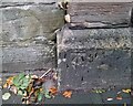
Ordnance Survey Cut Mark
This OS cut mark can be found on the wall post of Westgate Hill Cemetery. It marks a point 83.814m above mean sea level.
Image: © Adrian Dust
Taken: 21 Sep 2024
0.07 miles
7
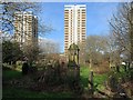
Westgate Hill Cemetery
View towards the flats on Westgate Road: Vallum Court (left) and Westgate Court (centre). The third block of flats off screen to the right is Todd's Nook.
Image: © Andrew Curtis
Taken: 27 Jan 2016
0.07 miles
8

Westgate Hill Cemetery (2)
Shows the location of Image
Image: © Mike Quinn
Taken: 5 May 2016
0.07 miles
9

Newcastle Carpets and Beds
Newcastle Carpets and Beds occupies this grandiose building on the corner of Elswick Road and Rye Hill. But what was the building originally? Unfortunately examination of old Ordnance Survey maps does not yield any clues.
Image: © Oliver Dixon
Taken: 1 Jun 2023
0.08 miles
10
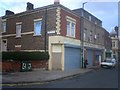
Corner of Elswick Road and Elswick Row
Image: © Anthony Foster
Taken: 25 Nov 2006
0.08 miles