
IMAGES TAKEN NEAR TO
Westgate Road, NEWCASTLE UPON TYNE, NE4 6EY
Introduction
This page details the photographs taken nearby to Westgate Road, NE4 6EY by members of the Geograph project.
The Geograph project started in 2005 with the aim of publishing, organising and preserving representative images for every square kilometre of Great Britain, Ireland and the Isle of Man.

There are currently over 7.5m images from over14,400 individuals and you can help contribute to the project by visiting https://www.geograph.org.uk
Image Map
Images are licensed for reuse under creativecommons.org/licenses/by-sa/2.0
Notes
- Clicking on the map will re-center to the selected point.
- The higher the marker number, the further away the image location is from the centre of the postcode.
Image Listing (318 Images Found)
Images are licensed for reuse under creativecommons.org/licenses/by-sa/2.0
Image
Details
Distance
1
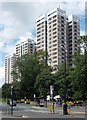
Todd's Nook flats, Westgate Road, Newcastle
Three point blocks built on T. Dan Smith's watch, between 1961 and 1964. From left to right, Vallum Court, Westgate Court, and Todd's Nook.
Image: © Stephen Richards
Taken: 16 Aug 2012
0.01 miles
2

Vallum Court, Westgate Court and Todd's Nook, Westgate Road, NE4
Image: © Mike Quinn
Taken: 30 Aug 2016
0.01 miles
3
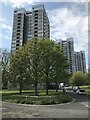
Westgate Hill tower blocks
From the camera the towers are named Todd’s Nook, Westgate Court and Vallum Court
Image: © Anthony Foster
Taken: 13 May 2021
0.02 miles
4

Todd's Nook Flats
On Westgate Road in the west end of Newcastle. This is a development of three tower blocks of flats built in 1961-65. They comprise 20 stories, giving a height of 58m (190ft), and form a prominent landmark in the western part of the city.
Image: © Robert Graham
Taken: 27 Aug 2019
0.02 miles
5
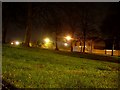
Grass by Westgate Road
Between the junction of Big Lamp and the highrise flats at Todd's Nook.
Image: © Stephen Sweeney
Taken: 12 Jan 2009
0.03 miles
6
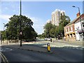
Looking west along Westgate Road
View from the junction with Elswick Road, on the left. Ahead are the Todd's Nook Flats, built in 1961-65, as part of the infamous T Dan Smiths rebuilding of Newcastle. They form a very prominent landmark in the west end of the city, particularly as they are on the top of Westgate Hill.
Image: © Robert Graham
Taken: 27 Aug 2019
0.03 miles
7
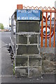
Benchmark on wall pier of Mansfield Street
Ordnance Survey cut mark benchmark described on the Bench Mark Database at http://www.bench-marks.org.uk/bm43174
Image: © Roger Templeman
Taken: 21 May 2012
0.03 miles
8
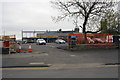
Entrance to building site for new mosque, Mansfield Street
It appears that a section of the roadside wall has been removed to provide the entrance with a new wall pier built at the left hand side while retaining an existing pier (which has an OS benchmark Image) on the right hand side.
Image: © Roger Templeman
Taken: 21 May 2012
0.03 miles
9
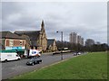
Top of Westgate Hill
Westgate Road with the 1960s Todd Nook tower blocks of flats, part of the T Dan Smith period in Newcastle when no scheme was too grand to have a chance of completion. On a clear day I could see these 3 from my bedroom window 3 miles away
Image: © Chris Morgan
Taken: 13 Feb 2019
0.04 miles
10
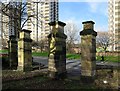
Westgate Hill Cemetery, gateway on Westgate Road
Image: © Andrew Curtis
Taken: 27 Jan 2016
0.04 miles