
IMAGES TAKEN NEAR TO
Winchester Terrace, NEWCASTLE UPON TYNE, NE4 6EH
Introduction
This page details the photographs taken nearby to Winchester Terrace, NE4 6EH by members of the Geograph project.
The Geograph project started in 2005 with the aim of publishing, organising and preserving representative images for every square kilometre of Great Britain, Ireland and the Isle of Man.

There are currently over 7.5m images from over14,400 individuals and you can help contribute to the project by visiting https://www.geograph.org.uk
Image Map
Images are licensed for reuse under creativecommons.org/licenses/by-sa/2.0
Notes
- Clicking on the map will re-center to the selected point.
- The higher the marker number, the further away the image location is from the centre of the postcode.
Image Listing (420 Images Found)
Images are licensed for reuse under creativecommons.org/licenses/by-sa/2.0
Image
Details
Distance
2

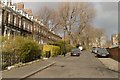
Winchester Terrace, NE4
The terrace is Grade II listed https://www.historicengland.org.uk/listing/the-list/list-entry/1355298 .
Image: © Mike Quinn
Taken: 24 May 2010
0.01 miles
3

Back lane in Summerhill, Newcastle
In the Summerhill area on the western side of Newcastle city centre. This is the back lane between the Bowls Club on the right, and Summerhill Park on the left. The Summerhill area was built in the early-mid 19th century as superior housing on the edge of the town, as it was then.
Image: © Robert Graham
Taken: 27 Aug 2019
0.02 miles
4
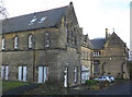
St Anne's Convent, Summerhill Grove, Newcastle
Image: © Roger Cornfoot
Taken: 9 Feb 2010
0.02 miles
5
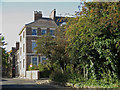
Summerhill Grove / Winchester Terrace, NE4
See also Image
Image: © Mike Quinn
Taken: 2 Oct 2018
0.02 miles

7
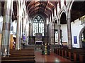
Interior of St Matthew's, Big Lamp, Newcastle
Considered to be one of the finest Victorian churches in the region. It was shoe-horned into this built-up site between 1880 and 1905, and is almost square.
Image: © Christine Johnstone
Taken: 4 Mar 2010
0.02 miles
9
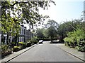
View down Summerhill Street
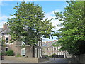
Looking south down the street to the junction with Lancaster Street, on the left. These streets were built between 1851-55, as part of the development of this area on the west side of Newcastle city centre. It was a high class area of superior housing away from the city slums. Even today, the tree lined streets have a very different feel from the surrounding area.
Image: © Robert Graham
Taken: 27 Aug 2019
0.03 miles
10
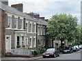
Summerhill Street, NE4
The east side, south of Image The terrace is Grade II listed https://www.historicengland.org.uk/listing/the-list/list-entry/1121125 .
Image: © Mike Quinn
Taken: 30 Jun 2016
0.03 miles