
IMAGES TAKEN NEAR TO
Westgate Road, NEWCASTLE UPON TYNE, NE4 6BE
Introduction
This page details the photographs taken nearby to Westgate Road, NE4 6BE by members of the Geograph project.
The Geograph project started in 2005 with the aim of publishing, organising and preserving representative images for every square kilometre of Great Britain, Ireland and the Isle of Man.

There are currently over 7.5m images from over14,400 individuals and you can help contribute to the project by visiting https://www.geograph.org.uk
Image Map
Images are licensed for reuse under creativecommons.org/licenses/by-sa/2.0
Notes
- Clicking on the map will re-center to the selected point.
- The higher the marker number, the further away the image location is from the centre of the postcode.
Image Listing (123 Images Found)
Images are licensed for reuse under creativecommons.org/licenses/by-sa/2.0
Image
Details
Distance
1
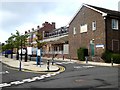
The old Newcastle General Hospital
The original buildings are shuttered up, but to the rear there are a number of new buildings on what is now the Newcastle University/Newcastle Hospitals Campus for Ageing and Vitality.
Image: © Oliver Dixon
Taken: 30 Jul 2019
0.03 miles
2
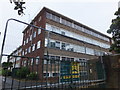
"The General" scheduled for demolition
Part of Newcastle General Hospital, fenced off and about to go (picture taken from the back lane of Wingrove Avenue). I'd wager that there are very few (if any!) Tyneside families without some memory of this historic hospital. http://en.wikipedia.org/wiki/Newcastle_General_Hospital
Image: © Barbara Carr
Taken: 6 Sep 2013
0.06 miles
3
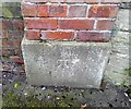
Ordnance Survey Cut Mark
This OS cut mark can be found on the gatepost east side of the lane. It marks a point 109.109m above mean sea level.
Image: © Adrian Dust
Taken: 21 Sep 2024
0.07 miles
4
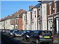
Wingrove Avenue, NE4 (2)
The east side, around Agricola Road.
Image: © Mike Quinn
Taken: 1 Dec 2016
0.09 miles
5
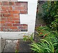
Ordnance Survey Cut Mark
This OS cut mark can be found on No5 Crossley Terrace. It marks a point 104.745m above mean sea level.
Image: © Adrian Dust
Taken: 21 Sep 2024
0.09 miles
6
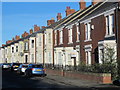
Wingrove Avenue, NE4 (3)
The east side, north of Agricola Road.
Image: © Mike Quinn
Taken: 1 Dec 2016
0.09 miles
7

Vagrant Cells
Vagrant ward part of defunct General Hospital
Image: © colin lancaster
Taken: 22 Nov 2012
0.10 miles
8
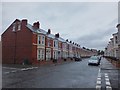
Wingrove Avenue
Some fine houses in the west end of Newcastle.
Image: © Barbara Carr
Taken: 6 Sep 2013
0.11 miles
9

Wingrove Avenue, NE4 (4)
The east side, south of Hadrian Road.
Image: © Mike Quinn
Taken: 1 Dec 2016
0.11 miles
10
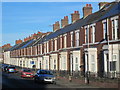
Wingrove Avenue, NE4
The east side, between Westgate Road and Agricola Road.
Image: © Mike Quinn
Taken: 1 Dec 2016
0.11 miles