
IMAGES TAKEN NEAR TO
Greenfield Place, NEWCASTLE UPON TYNE, NE4 6AX
Introduction
This page details the photographs taken nearby to Greenfield Place, NE4 6AX by members of the Geograph project.
The Geograph project started in 2005 with the aim of publishing, organising and preserving representative images for every square kilometre of Great Britain, Ireland and the Isle of Man.

There are currently over 7.5m images from over14,400 individuals and you can help contribute to the project by visiting https://www.geograph.org.uk
Image Map
Images are licensed for reuse under creativecommons.org/licenses/by-sa/2.0
Notes
- Clicking on the map will re-center to the selected point.
- The higher the marker number, the further away the image location is from the centre of the postcode.
Image Listing (629 Images Found)
Images are licensed for reuse under creativecommons.org/licenses/by-sa/2.0
Image
Details
Distance
1

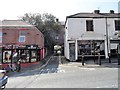
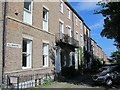
Shops on Westgate Hill
As Westgate Road climbs the hill out of Newcastle's city centre and into the western suburbs, it becomes very culturally diverse. As can be seen here from the variety of cafes and shops. These houses were built in the early 19th century, as the town expanded. Greenfield Place, which can be seen joining the main street beside the white building to the left, was built in 1823.
Image: © Robert Graham
Taken: 27 Aug 2019
0.00 miles
2
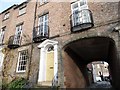
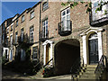
Back alley off Westgate Road
This is Greenfield Place, a short alleyway which leads through an archway under Swinburn Place to Summerhill Park behind Westgate Road.
Image: © Robert Graham
Taken: 27 Aug 2019
0.00 miles
3
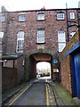
Entry to Greenfield Place
This is one of the earliest built streets in this part of Newcastle. The area, then on the western edge of the town, was developed in Regency times as superior housing. This terrace, behind Westgate road, was built in 1823.
Image: © Robert Graham
Taken: 13 Nov 2019
0.00 miles
4
Arched entrance to Greenfield Place, off Westgate Road
Image: © Christine Johnstone
Taken: 4 Mar 2010
0.00 miles
8
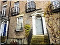
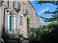
Blue plaque at Greenfield Terrace
This 1820's built terrace lies behind Westgate Road in Newcastle. The plaque records that the famous engineer Robert Stephenson lived here between 1829-33.
Image: © Robert Graham
Taken: 13 Nov 2019
0.02 miles
10
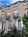
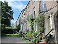
5 Greenfield Place, NE4
Robert Stephenson lived here from 1829 to 1833 - see Image
Image: © Mike Quinn
Taken: 30 Aug 2016
0.02 miles