
IMAGES TAKEN NEAR TO
Westgate Road, NEWCASTLE UPON TYNE, NE4 6AL
Introduction
This page details the photographs taken nearby to Westgate Road, NE4 6AL by members of the Geograph project.
The Geograph project started in 2005 with the aim of publishing, organising and preserving representative images for every square kilometre of Great Britain, Ireland and the Isle of Man.

There are currently over 7.5m images from over14,400 individuals and you can help contribute to the project by visiting https://www.geograph.org.uk
Image Map
Images are licensed for reuse under creativecommons.org/licenses/by-sa/2.0
Notes
- Clicking on the map will re-center to the selected point.
- The higher the marker number, the further away the image location is from the centre of the postcode.
Image Listing (993 Images Found)
Images are licensed for reuse under creativecommons.org/licenses/by-sa/2.0
Image
Details
Distance
1

178, Westgate Road, NE1
The house of c 1820 is Grade II listed https://www.historicengland.org.uk/listing/the-list/list-entry/1338525 ; it is shown on the right hand side of Image
Image: © Mike Quinn
Taken: 3 May 2016
0.01 miles
2

Westgate Road, NE4 (2)
The north side, just west of St. James' Boulevard.
Image: © Mike Quinn
Taken: 7 Apr 2016
0.01 miles
3

Westgate Road, NE4
The north side, just west of St. James' Boulevard. The two end houses on the right, Nos. 172 and 174, are Grade II listed https://www.historicengland.org.uk/listing/the-list/list-entry/1355329 .
Image: © Mike Quinn
Taken: 7 Apr 2016
0.01 miles
4

172-194 Westgate Road, Newcastle
Beyond the ring road, Westgate Road retains some early C19th terraces, many since built out to accommodate shops. Grade II listed.
Image: © Stephen Richards
Taken: 16 Aug 2012
0.02 miles
5

190, Westgate Road, NE1
The house of c 1825 is Grade II listed https://www.historicengland.org.uk/listing/the-list/list-entry/1024734 .
Image: © Mike Quinn
Taken: 3 May 2016
0.02 miles
6

172 & 174, Westgate Road, NE1
These houses of c 1720 are Grade II listed https://www.historicengland.org.uk/listing/the-list/list-entry/1355329 ; their location is shown in Image
Image: © Mike Quinn
Taken: 3 May 2016
0.02 miles
7
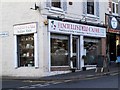
Fanciulli's Deli Caffe, Westgate Road / Blandford Square, NE4
Image: © Mike Quinn
Taken: 29 Nov 2016
0.03 miles
8
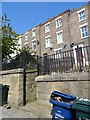
Old town houses on Westgate Hill
These terraced houses on the north side of Westgate Road, going up the hill, were originally built in the early 19th century as houses for the better off. They were clear of the slums in the city centre and the developing industry along the River Tyne. Many have been converted into flats, often for students.
Image: © Robert Graham
Taken: 27 Aug 2019
0.03 miles
10
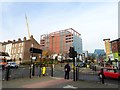
Intersection of Blenheim Street and Westgate Road
Busy intersection of two major roads on the west side of Newcastle city centre.
Image: © Robert Graham
Taken: 13 Nov 2019
0.03 miles