
IMAGES TAKEN NEAR TO
Westgate Road, NEWCASTLE UPON TYNE, NE4 6AH
Introduction
This page details the photographs taken nearby to Westgate Road, NE4 6AH by members of the Geograph project.
The Geograph project started in 2005 with the aim of publishing, organising and preserving representative images for every square kilometre of Great Britain, Ireland and the Isle of Man.

There are currently over 7.5m images from over14,400 individuals and you can help contribute to the project by visiting https://www.geograph.org.uk
Image Map
Images are licensed for reuse under creativecommons.org/licenses/by-sa/2.0
Notes
- Clicking on the map will re-center to the selected point.
- The higher the marker number, the further away the image location is from the centre of the postcode.
Image Listing (484 Images Found)
Images are licensed for reuse under creativecommons.org/licenses/by-sa/2.0
Image
Details
Distance
1
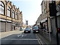
Looking down Westgate Road
This view is from the top of Westgate Hill, looking eastwards back to the city centre. The new skyscraper of Hadrian's Tower is rising in the distance. Westgate Hall, former Methodist Chapel, is on the left.
Image: © Robert Graham
Taken: 27 Aug 2019
0.01 miles
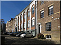
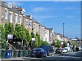
4
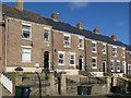
252 - 260, Westgate Road, NE1
The house numbers increase uphill, from right to left; no.260 (left) is Grade II listed - see Image
Image: © Mike Quinn
Taken: 2 Oct 2018
0.02 miles
5
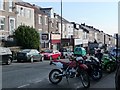
Motorbikes for sale
Between Corporation Street and Blenheim Street, Westgate Road is dominated by shops selling everything bikers need, from motorbikes to specialised accessories.
The shops are often single storey units built in the gardens of the older terraced houses.
Image: © Christine Johnstone
Taken: 4 Mar 2010
0.02 miles
6
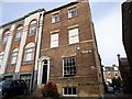
The House Through Time, Newcastle
This house, No 5 Ravensworth Terrace, was the subject of the latest edition of the BBC series "A House Through Time", broadcast in 2019. The terrace was built in 1823, as part of a late Georgian expansion of the town to the west of the town walls.
Image: © Robert Graham
Taken: 13 Nov 2019
0.02 miles
7
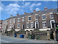
252 - 260, Westgate Road, NE1
Shows the location of Image (left).
Image: © Mike Quinn
Taken: 5 May 2016
0.02 miles
8
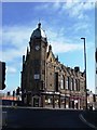
Prudhoe Street Mission, Westgate Hall, Corporation Street
Founded in 1910 and still going strong.The mission was re-located to here after the construction of Eldon Square Shopping Centre. Prudhoe Street itself was located behind Marks & Spencer on Northumberland Street. [with thanks to A. McCarron for this information]
Image: © Christine Johnstone
Taken: 4 Mar 2010
0.02 miles
10

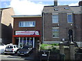
260, Westgate Road, NE1
This house of c 1820 is Grade II listed https://www.historicengland.org.uk/listing/the-list/list-entry/1121994 . However, the text of the listing includes "Steps up to 5-panel door and fanlight in doorcase of tapered fluted pilasters with block capitals supporting brackets, cornice". This house is one of a terrace of five similar houses Image Houses 252 and 254 have doorways as described in the listing, but the doorways to nos 256, 258 and 260 have clearly been (similarly) modified by removal of the pilasters and cornice, and the fanlights have curved tops, not rectangular ones.
Image: © Mike Quinn
Taken: 5 May 2016
0.02 miles