IMAGES TAKEN NEAR TO
Leazes Lane, HEXHAM, NE46 3AH
Introduction
This page details the photographs taken nearby to Leazes Lane, NE46 3AH by members of the Geograph project.
The Geograph project started in 2005 with the aim of publishing, organising and preserving representative images for every square kilometre of Great Britain, Ireland and the Isle of Man.

There are currently over 7.5m images from over14,400 individuals and you can help contribute to the project by visiting https://www.geograph.org.uk
Image Map
Images are licensed for reuse under creativecommons.org/licenses/by-sa/2.0
Notes
- Clicking on the map will re-center to the selected point.
- The higher the marker number, the further away the image location is from the centre of the postcode.
Image Listing (51 Images Found)
Images are licensed for reuse under creativecommons.org/licenses/by-sa/2.0
Image
Details
Distance
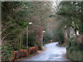
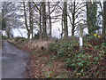
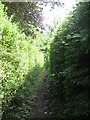
6
Shaw's "Lane"
The lane deteriorates into a footpath from here north to West Road.
Image: © Mike Quinn
Taken: 6 Dec 2007
0.10 miles
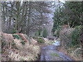
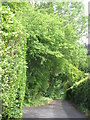
7
Footpath between Leazes Lane and Beech Hill (2)
Image: © Mike Quinn
Taken: 15 Jul 2010
0.12 miles
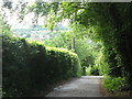
8
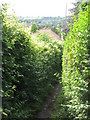
Footpath between Leazes Lane and Beech Hill
Image: © Mike Quinn
Taken: 15 Jul 2010
0.12 miles