IMAGES TAKEN NEAR TO
Merryleazes, Allendale Road, HEXHAM, NE46 2NE
Introduction
This page details the photographs taken nearby to Merryleazes, Allendale Road, NE46 2NE by members of the Geograph project.
The Geograph project started in 2005 with the aim of publishing, organising and preserving representative images for every square kilometre of Great Britain, Ireland and the Isle of Man.

There are currently over 7.5m images from over14,400 individuals and you can help contribute to the project by visiting https://www.geograph.org.uk
Image Map
Images are licensed for reuse under creativecommons.org/licenses/by-sa/2.0
Notes
- Clicking on the map will re-center to the selected point.
- The higher the marker number, the further away the image location is from the centre of the postcode.
Image Listing (45 Images Found)
Images are licensed for reuse under creativecommons.org/licenses/by-sa/2.0
Image
Details
Distance
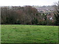
1
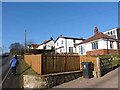
A small cluster of houses on the Allendale Road
A short distance beyond the western edge of Hexham.
Image: © Oliver Dixon
Taken: 29 Jan 2011
0.03 miles

3
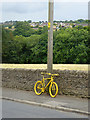
A yellow bike in Hexham
Stage 5 of the Aviva Tour of Britain on September 10th runs from Prudhoe in the Tyne valley to the finish on Hartside Pass, the second highest A road in England. At many of the settlements along the way, yellow bikes have been installed by the roadside in anticipation of the occasion - over 20 each at Langwathby (see Image) and Melmerby (see Image). Haydon Bridge rises to fifteen (Image'>Image]) and even Riding Mill (Image) manages half a dozen; there the bikes are painted in red and yellow stripes - the colours of the Northumberland flag.
But Hexham, one of the largest towns on the route can only manage four specimens to date - this one is sited on the Allendale Road out of town. But maybe some more will materialise before the big day.
The Highford estate can be seen in the distance.
Image: © Oliver Dixon
Taken: 2 Sep 2015
0.07 miles
6
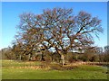
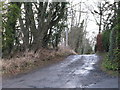
Oak trees in winter
On the western edge of Hexham.
Image: © Oliver Dixon
Taken: 29 Jan 2011
0.10 miles
7
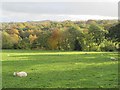
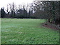
The valley of Cockshaw Burn south of Shaws Lane
Image: © Mike Quinn
Taken: 1 Nov 2013
0.11 miles
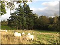
9
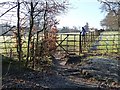
Footpath and gate
On the western edge of Hexham, leading out to the Allendale Road.
Image: © Oliver Dixon
Taken: 29 Jan 2011
0.11 miles