
IMAGES TAKEN NEAR TO
HEXHAM, NE46 1SU
Introduction
This page details the photographs taken nearby to NE46 1SU by members of the Geograph project.
The Geograph project started in 2005 with the aim of publishing, organising and preserving representative images for every square kilometre of Great Britain, Ireland and the Isle of Man.

There are currently over 7.5m images from over14,400 individuals and you can help contribute to the project by visiting https://www.geograph.org.uk
Image Map
Images are licensed for reuse under creativecommons.org/licenses/by-sa/2.0
Notes
- Clicking on the map will re-center to the selected point.
- The higher the marker number, the further away the image location is from the centre of the postcode.
Image Listing (5 Images Found)
Images are licensed for reuse under creativecommons.org/licenses/by-sa/2.0
Image
Details
Distance
3
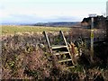
Cockshaw Rigg
Ladder stile and footpath from Smelting Syke to Dotland Park. Tynedale can be seen in the distance.
Image: © Oliver Dixon
Taken: 2 Dec 2009
0.10 miles
4
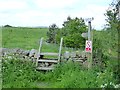
No cycling!
The stile and rough path don't appear very promising for cycling, but nevertheless It seems to have been necessary to add a "No cycling" sign on the path to Dotland Park (see also Image)..
Image: © Oliver Dixon
Taken: 28 May 2018
0.11 miles
5
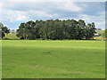
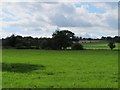
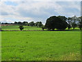
Pastures and small plantation on Cockshaw Rigg
Looking past the left hand (west) side of the plantation, it's just possible to see the buildings at Image photographed by Mick Garratt.
Image: © Mike Quinn
Taken: 9 Aug 2011
0.18 miles