
IMAGES TAKEN NEAR TO
Sidney Grove, NEWCASTLE UPON TYNE, NE4 5PD
Introduction
This page details the photographs taken nearby to Sidney Grove, NE4 5PD by members of the Geograph project.
The Geograph project started in 2005 with the aim of publishing, organising and preserving representative images for every square kilometre of Great Britain, Ireland and the Isle of Man.

There are currently over 7.5m images from over14,400 individuals and you can help contribute to the project by visiting https://www.geograph.org.uk
Image Map
Images are licensed for reuse under creativecommons.org/licenses/by-sa/2.0
Notes
- Clicking on the map will re-center to the selected point.
- The higher the marker number, the further away the image location is from the centre of the postcode.
Image Listing (115 Images Found)
Images are licensed for reuse under creativecommons.org/licenses/by-sa/2.0
Image
Details
Distance
1
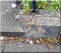
Ordnance Survey Cut Mark
This OS cut mark can be found on the wall junction of Nos35/37 Brighton Grove. It marks a point 101.553m above mean sea level.
Image: © Adrian Dust
Taken: 21 Sep 2024
0.04 miles
2
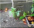
Ordnance Survey Cut Mark
This OS cut mark can be found on the NE angle of St Augustine's Church. It marks a point 99.249m above mean sea level.
Image: © Adrian Dust
Taken: 21 Sep 2024
0.05 miles
3
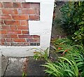
Ordnance Survey Cut Mark
This OS cut mark can be found on No5 Crossley Terrace. It marks a point 104.745m above mean sea level.
Image: © Adrian Dust
Taken: 21 Sep 2024
0.07 miles
4
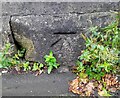
Ordnance Survey Cut Mark
This OS cut mark can be found on the wall of No59 Gainsbro Gove. It marks a point 100.383m above mean sea level.
Image: © Adrian Dust
Taken: 21 Sep 2024
0.08 miles
5
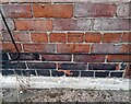
Ordnance Survey Cut Mark
This OS cut mark can be found on No34 Fenham Road. It marks a point 100.423m above mean sea level.
Image: © Adrian Dust
Taken: 21 Sep 2024
0.08 miles
8
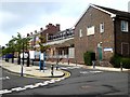
The old Newcastle General Hospital
The original buildings are shuttered up, but to the rear there are a number of new buildings on what is now the Newcastle University/Newcastle Hospitals Campus for Ageing and Vitality.
Image: © Oliver Dixon
Taken: 30 Jul 2019
0.11 miles
9
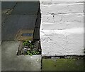
Ordnance Survey Cut Mark
This OS cut mark can be found on No2 Belsay Place. It marks a point 105.543m above mean sea level.
Image: © Adrian Dust
Taken: 21 Sep 2024
0.12 miles
10
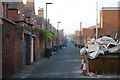
Back of Sidney Grove, Fenham
A Typical Tyneside backstreet, black wheelie bins for general waste, blue wheelies are for recyclables
Image: © hayley green
Taken: 25 Apr 2009
0.12 miles