
IMAGES TAKEN NEAR TO
Darnell Place, NEWCASTLE UPON TYNE, NE4 5EX
Introduction
This page details the photographs taken nearby to Darnell Place, NE4 5EX by members of the Geograph project.
The Geograph project started in 2005 with the aim of publishing, organising and preserving representative images for every square kilometre of Great Britain, Ireland and the Isle of Man.

There are currently over 7.5m images from over14,400 individuals and you can help contribute to the project by visiting https://www.geograph.org.uk
Image Map
Images are licensed for reuse under creativecommons.org/licenses/by-sa/2.0
Notes
- Clicking on the map will re-center to the selected point.
- The higher the marker number, the further away the image location is from the centre of the postcode.
Image Listing (69 Images Found)
Images are licensed for reuse under creativecommons.org/licenses/by-sa/2.0
Image
Details
Distance
1
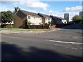
Avison Street, Newcastle upon Tyne
Looking across Stanhope Street to Avison Street. A terrace of houses stands on the eastern side of the road.
Image: © Graham Robson
Taken: 6 Jun 2020
0.06 miles
2

Avison Street, NE4
As far as I'm aware, apart from a couple of plaques and the City Library building https://www.geograph.org.uk/search.php?i=219405055 , this street with the block of flats "Avison Court", and Image are the only acknowledgements to the 18th C composer Charles Avison https://en.wikipedia.org/wiki/Charles_Avison in Newcastle.
Image: © Mike Quinn
Taken: 11 Aug 2026
0.06 miles
3
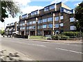
Flats, Stanhope Street, Newcastle upon Tyne
A block of flats on the southern side of Stanhope Street in Newcastle.
Image: © Graham Robson
Taken: 6 Jun 2020
0.07 miles
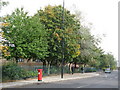
5
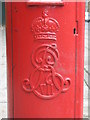
Edward VII postbox, Stanhope Street, NE4 - royal cipher
See Image
Image: © Mike Quinn
Taken: 5 Oct 2010
0.09 miles
6
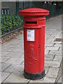
Edward VII postbox, Stanhope Street, NE4
Image: © Mike Quinn
Taken: 5 Oct 2010
0.09 miles
7
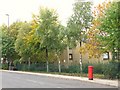
Stanhope Street, NE4 (2)
Shows the location of Image
Image: © Mike Quinn
Taken: 5 Oct 2010
0.10 miles
8
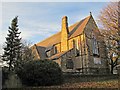
The Church of St. Philip, St. Philip's Close, NE4 (2)
See Image
Image: © Mike Quinn
Taken: 29 Nov 2016
0.10 miles
9
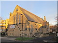
The Church of St. Philip, St. Philip's Close, NE4
Currently the Deeper Life Bible Church "... your spiritual welfare is our concern". The church is Grade II listed https://www.historicengland.org.uk/listing/the-list/list-entry/1024773 .
Image: © Mike Quinn
Taken: 29 Nov 2016
0.11 miles
10
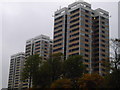
The Most Visible Tower Blocks in Newcastle
Todd's Nook, Vallum Court and Westgate Court sit high at the top of Westgate Hill and thus can be seen for dozens of miles in all directions.
Image: © MSX
Taken: 24 Oct 2005
0.11 miles