IMAGES TAKEN NEAR TO
Aydon Road, CORBRIDGE, NE45 5EP
Introduction
This page details the photographs taken nearby to Aydon Road, NE45 5EP by members of the Geograph project.
The Geograph project started in 2005 with the aim of publishing, organising and preserving representative images for every square kilometre of Great Britain, Ireland and the Isle of Man.

There are currently over 7.5m images from over14,400 individuals and you can help contribute to the project by visiting https://www.geograph.org.uk
Image Map
Images are licensed for reuse under creativecommons.org/licenses/by-sa/2.0
Notes
- Clicking on the map will re-center to the selected point.
- The higher the marker number, the further away the image location is from the centre of the postcode.
Image Listing (15 Images Found)
Images are licensed for reuse under creativecommons.org/licenses/by-sa/2.0
Image
Details
Distance
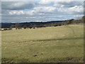
1
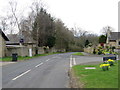
Road (B6321) at Piperclose
Looking south-westward.
Image: © Peter Wood
Taken: 30 Mar 2017
0.10 miles
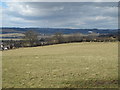
2
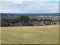
Farmland south of the A69 and the northern outskirts of Corbridge
Image: © Mike Quinn
Taken: 4 Apr 2013
0.11 miles
3
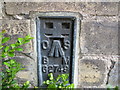
Ordnance Survey Flush Bracket G2749
This bracket can be found on the wall of a house - private dwelling - at Piperclose. The benchmark height is recorded as being 95.797 metres above sea level.
For more detail see : http://www.bench-marks.org.uk/bm14896
Image: © Peter Wood
Taken: 30 Mar 2017
0.13 miles
4
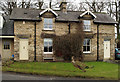
Semi-detached houses in Corbridge
A pair of semi-detached houses built from pale brick, the one to the left extended in recent times. They stand on the south-east side of the B6321 on the outskirts of the village. The house to the left has an OS. flush bracket - No. G2749, not in view in this image.
Image: © Trevor Littlewood
Taken: 5 Feb 2011
0.13 miles
8
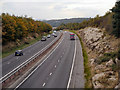
A69 at Gallowhill
Looking west from the bridge at Aydon Road.
Image: © David Dixon
Taken: 18 Oct 2012
0.22 miles
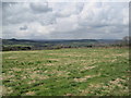
10
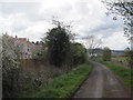
Bridleway towards Corbridge
New housing estate in progress
Image: © Les Hull
Taken: 27 Apr 2016
0.22 miles