
IMAGES TAKEN NEAR TO
Millfield Road, RIDING MILL, NE44 6DL
Introduction
This page details the photographs taken nearby to Millfield Road, NE44 6DL by members of the Geograph project.
The Geograph project started in 2005 with the aim of publishing, organising and preserving representative images for every square kilometre of Great Britain, Ireland and the Isle of Man.

There are currently over 7.5m images from over14,400 individuals and you can help contribute to the project by visiting https://www.geograph.org.uk
Image Map
Images are licensed for reuse under creativecommons.org/licenses/by-sa/2.0
Notes
- Clicking on the map will re-center to the selected point.
- The higher the marker number, the further away the image location is from the centre of the postcode.
Image Listing (55 Images Found)
Images are licensed for reuse under creativecommons.org/licenses/by-sa/2.0
Image
Details
Distance
1
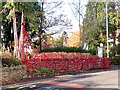
Wall of poppies
Along the main road in Riding Mill. The village of Riding Mill seemed to be particularly well decorated with poppies for Armistice Day, 2018, many of them knitted.
Image: © Oliver Dixon
Taken: 10 Nov 2018
0.07 miles
2
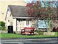
Poppies at Riding Mill
Outside a bungalow in Riding Close. The village of Riding Mill seemed to be particularly well decorated with poppies for Armistice Day, 2018, many of them knitted.
Image: © Oliver Dixon
Taken: 10 Nov 2018
0.08 miles
3
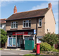
Newsagent, Riding Mill - August 2016
One of the few commercial premises in the village of Riding Mill, the newsagent now appears to be closed.
Image: © The Carlisle Kid
Taken: 24 Aug 2016
0.08 miles
4
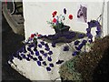
Purple poppies at Riding Mill
Outside the Wellington public house. The village of Riding Mill seemed to be particularly well decorated with poppies for Armistice Day, 2018, many of them knitted. Purple poppies were a novelty this year, commemorating the animals which died in the War.
Image: © Oliver Dixon
Taken: 10 Nov 2018
0.09 miles
5
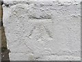
Ordnance Survey Cut Mark
This somewhat over-painted mark can be found on the roadside wall of The Wellington PH in Riding Mill. The benchmark height has been calculated as being 26.8956 metres above sea level.
For more detail see : http://www.bench-marks.org.uk/bm56763
Image: © Peter Wood
Taken: 14 Jul 2018
0.09 miles
6
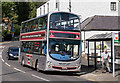
Newcastle 'bus at Riding Mill - August 2016
A Newcastle bound 'bus stops outside The Wellington in Riding Mill.
Image: © The Carlisle Kid
Taken: 24 Aug 2016
0.09 miles
7
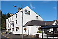
The Wellington, Riding Mill - August 2016
No useful historical information found on this building.
Photograph is for record only - I have no connection with this business and cannot advise on its products or services.
Image: © The Carlisle Kid
Taken: 24 Aug 2016
0.09 miles
8
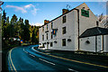
The Wellington
The Wellington public house at Riding Mill.
Image: © Peter McDermott
Taken: 28 Dec 2011
0.09 miles
9
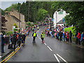
Olympic torch relay through Riding Mill
The lull between the sponsors' floats and the torch.
Image: © Hugh Venables
Taken: 16 Jun 2012
0.10 miles
10
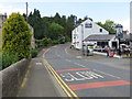
Main Road (A695) and The Wellington PH in Riding Mill
Looking north-westward.
Image: © Peter Wood
Taken: 14 Jul 2018
0.10 miles