IMAGES TAKEN NEAR TO
The Dene, WYLAM, NE41 8EW
Introduction
This page details the photographs taken nearby to The Dene, NE41 8EW by members of the Geograph project.
The Geograph project started in 2005 with the aim of publishing, organising and preserving representative images for every square kilometre of Great Britain, Ireland and the Isle of Man.

There are currently over 7.5m images from over14,400 individuals and you can help contribute to the project by visiting https://www.geograph.org.uk
Image Map
Images are licensed for reuse under creativecommons.org/licenses/by-sa/2.0
Notes
- Clicking on the map will re-center to the selected point.
- The higher the marker number, the further away the image location is from the centre of the postcode.
Image Listing (122 Images Found)
Images are licensed for reuse under creativecommons.org/licenses/by-sa/2.0
Image
Details
Distance
1
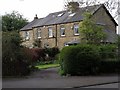
Houses near Florist Hall, The Dene, Wylam
Like Florist Hall these houses (Florist Cottages) are stone built and presumably much earlier than many of the surrounding houses on the estate. Florist (or Florists') Hall is one of the few buildings in Wylam on the first edition OS map and is located behind the cottages.
"At a short distance from the colliery stands Florists' Hall, with its extensive garden, containing near seven acres of land, and which is famed for producing the best and earliest strawberries in the north. It is the property of Mrs. Hall, of Newcastle."
Eneas Mackenzie (1825).
Image: © Andrew Curtis
Taken: 27 Apr 2018
0.02 miles
2
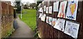
Children's messages of support for the NHS, Engine Dene, Wylam
Use of the rainbow symbol during the Coranavirus outbreak is described here Image
Image: © Andrew Curtis
Taken: 3 Apr 2020
0.04 miles
3
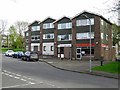
Dene Road, Wylam
Showing the takeaway, Wylam's Garden, and doctors surgery.
Image: © Andrew Curtis
Taken: 27 Apr 2018
0.04 miles
4
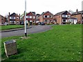
Detached houses, Woodvale Gardens, Wylam
Image: © Andrew Curtis
Taken: 27 Apr 2018
0.06 miles
5
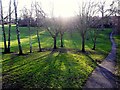
Engine Dene, Wylam
Engine Dene and the adjoining 'Brick Field' were once the site of a clay pit used for brick making in Victorian times. Brick makers were employed by the Blackett estate to manufacture bricks and tiles for use in the village. They were paid the equivalent of 4p for every 100 bricks produced and one man could make about 1000 bricks in a day. The Dene used to run down to the Wylam Iron Works and much of it was left as landscaped open space when the housing estate was built.
Image: © Andrew Curtis
Taken: 28 Dec 2011
0.07 miles
6
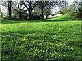
Engine Dene, Wylam
Engine Dene is an open space in the north part of Wylam village. See description here Image
Image: © Andrew Curtis
Taken: 27 Apr 2018
0.07 miles
7

Open space between Jackson Road & The Dene, Wylam
Formerly part of Engine Dene and an industrialised area when Wylam Iron Works was in operation around 1890. The land was not developed when the housing estate was built in the early 1960s.
Image: © Andrew Curtis
Taken: 27 Apr 2018
0.07 miles
8
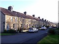
Algernon Terrace, Wylam
Algernon seems to have been a common name in these parts. The son of Charles Algernon Parsons, inventor of the steam turbine was Algernon George Parsons (b. 1886). He was killed in action during World War I in 1918, aged 31. Algernon was also a common family name of the Percy family, Dukes of Northumberland. Edward Algernon Blackett was the grandson of Christopher Blackett (1751-1829) owner of Wylam Colliery and major figure in development of the steam locomotive.
Image: © Andrew Curtis
Taken: 28 Dec 2011
0.08 miles
9
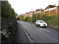
Main Road, Wylam
The walls lining the road in the village are largely composed of iron slag from the former iron works in the village.
Image: © Andrew Curtis
Taken: 25 Jan 2015
0.09 miles