IMAGES TAKEN NEAR TO
Woodvale Gardens, WYLAM, NE41 8ES
Introduction
This page details the photographs taken nearby to Woodvale Gardens, NE41 8ES by members of the Geograph project.
The Geograph project started in 2005 with the aim of publishing, organising and preserving representative images for every square kilometre of Great Britain, Ireland and the Isle of Man.

There are currently over 7.5m images from over14,400 individuals and you can help contribute to the project by visiting https://www.geograph.org.uk
Image Map (Loading...)


Getting Data...Please wait
Leaflet Map data © OpenStreetMap
Images are licensed for reuse under creativecommons.org/licenses/by-sa/2.0
Notes
- Clicking on the map will re-center to the selected point.
- The higher the marker number, the further away the image location is from the centre of the postcode.
Image Listing (126 Images Found)
Images are licensed for reuse under creativecommons.org/licenses/by-sa/2.0
Image
Details
Distance
1
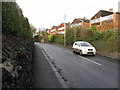
Main Road, Wylam
The walls lining the road in the village are largely composed of iron slag from the former iron works in the village.
Image: © Andrew Curtis
Taken: 25 Jan 2015
0.04 miles
2
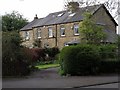
Houses near Florist Hall, The Dene, Wylam
Like Florist Hall these houses (Florist Cottages) are stone built and presumably much earlier than many of the surrounding houses on the estate. Florist (or Florists') Hall is one of the few buildings in Wylam on the first edition OS map and is located behind the cottages.
"At a short distance from the colliery stands Florists' Hall, with its extensive garden, containing near seven acres of land, and which is famed for producing the best and earliest strawberries in the north. It is the property of Mrs. Hall, of Newcastle."
Eneas Mackenzie (1825).
Image: © Andrew Curtis
Taken: 27 Apr 2018
0.04 miles
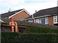
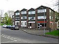
4
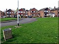
Detached houses, Woodvale Gardens, Wylam
Image: © Andrew Curtis
Taken: 27 Apr 2018
0.07 miles
5
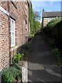
Cherry Tree Lane, Wylam
The lane (footpath) connects Main Road in Wylam to the south end of Algernon Terrace Image and provides easy access from the centre of the village to St Oswin's Church and the Church Hall.
Image: © Andrew Curtis
Taken: 27 Apr 2018
0.08 miles
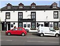
6
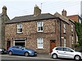
J A Stobo & Sons, Main Road, Wylam
Greengrocers shop on Main Road. Cherry Tree Lane is on the right side of the building Image
Image: © Andrew Curtis
Taken: 27 Apr 2018
0.08 miles
7
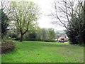
Open space between Jackson Road & The Dene, Wylam
Formerly part of Engine Dene and an industrialised area when Wylam Iron Works was in operation around 1890. The land was not developed when the housing estate was built in the early 1960s.
Image: © Andrew Curtis
Taken: 27 Apr 2018
0.08 miles
8
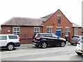
Wylam Masonic Hall, Chapel Lane, Wylam
On the opposite side of the road to Image
Image: © Andrew Curtis
Taken: 27 Apr 2018
0.08 miles
9
Dene Road, Wylam
Showing the takeaway, Wylam's Garden, and doctors surgery.
Image: © Andrew Curtis
Taken: 27 Apr 2018
0.08 miles