IMAGES TAKEN NEAR TO
Mollyfair Close, RYTON, NE40 4UZ
Introduction
This page details the photographs taken nearby to Mollyfair Close, NE40 4UZ by members of the Geograph project.
The Geograph project started in 2005 with the aim of publishing, organising and preserving representative images for every square kilometre of Great Britain, Ireland and the Isle of Man.

There are currently over 7.5m images from over14,400 individuals and you can help contribute to the project by visiting https://www.geograph.org.uk
Image Map
Images are licensed for reuse under creativecommons.org/licenses/by-sa/2.0
Notes
- Clicking on the map will re-center to the selected point.
- The higher the marker number, the further away the image location is from the centre of the postcode.
Image Listing (10 Images Found)
Images are licensed for reuse under creativecommons.org/licenses/by-sa/2.0
Image
Details
Distance
1
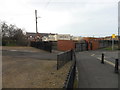
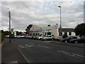
The Ark, Crawcrook
Replacing Image as a church, a soft play centre and a cafe.
Image: © Anthony Foster
Taken: 23 Sep 2016
0.08 miles
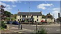
2
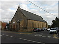
The Robert Young Memorial Methodist Church, Crawcrook
Image: © Bill Henderson
Taken: 20 Feb 2010
0.08 miles
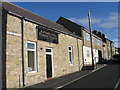
3
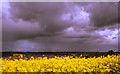
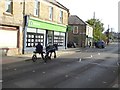
Big sky over Crawcrook
Image: © Mark Richards
Taken: 30 May 2005
0.11 miles
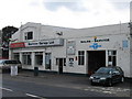
4
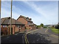
Kestrel Close, Crawcrook
Typo in the street sign which reads "Kestel Close".
Image: © Oliver Dixon
Taken: 23 Sep 2016
0.13 miles