IMAGES TAKEN NEAR TO
High Spen, ROWLANDS GILL, NE39 2HN
Introduction
This page details the photographs taken nearby to NE39 2HN by members of the Geograph project.
The Geograph project started in 2005 with the aim of publishing, organising and preserving representative images for every square kilometre of Great Britain, Ireland and the Isle of Man.

There are currently over 7.5m images from over14,400 individuals and you can help contribute to the project by visiting https://www.geograph.org.uk
Image Map
Images are licensed for reuse under creativecommons.org/licenses/by-sa/2.0
Notes
- Clicking on the map will re-center to the selected point.
- The higher the marker number, the further away the image location is from the centre of the postcode.
Image Listing (16 Images Found)
Images are licensed for reuse under creativecommons.org/licenses/by-sa/2.0
Image
Details
Distance
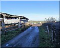
1
Farmyard at Strothers
The village of Greenside can be seen in the distance.
Image: © Robert Graham
Taken: 22 Nov 2021
0.03 miles
2
View through the trees to Strothers Farm
Farm sheds viewed from the path north from High Spen village.
Image: © Robert Graham
Taken: 22 Nov 2021
0.03 miles
3
Barn at Strothers Farm
A barn which appears to have been constructed from old telephone poles. Nice bit of recycling. The village in the distance is Greenside.
Image: © Robert Graham
Taken: 22 Nov 2021
0.04 miles
4
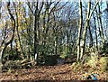
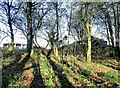
Sunken path in the wood
Path through the trees south of Stothers Farm. Sunken paths like this are usually a sign of an old one.
Image: © Robert Graham
Taken: 22 Nov 2021
0.06 miles
5
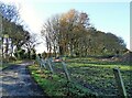
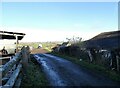
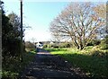
Access road to Strothers Farm
This track leads to the main road to High Spen.
Image: © Robert Graham
Taken: 22 Nov 2021
0.07 miles
6
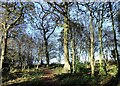
Copse south of Strothers Farm
At the north end of High Spen village.
Image: © Robert Graham
Taken: 22 Nov 2021
0.07 miles
7
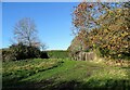
Allotments behind Strothers Terrace
On the north side of High Spen village.
Image: © Robert Graham
Taken: 22 Nov 2021
0.11 miles
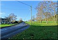
8
Looking down the track to Strothers Terrace
This is the access road to Strothers Farm from the main road at the terrace.
Image: © Robert Graham
Taken: 22 Nov 2021
0.13 miles
9
Top of the hill at High Spen
The north end of Glossop Street, at the highest point of the village.
Image: © Robert Graham
Taken: 22 Nov 2021
0.16 miles