IMAGES TAKEN NEAR TO
Ashtree Avenue, ROWLANDS GILL, NE39 2FE
Introduction
This page details the photographs taken nearby to Ashtree Avenue, NE39 2FE by members of the Geograph project.
The Geograph project started in 2005 with the aim of publishing, organising and preserving representative images for every square kilometre of Great Britain, Ireland and the Isle of Man.

There are currently over 7.5m images from over14,400 individuals and you can help contribute to the project by visiting https://www.geograph.org.uk
Image Map
Images are licensed for reuse under creativecommons.org/licenses/by-sa/2.0
Notes
- Clicking on the map will re-center to the selected point.
- The higher the marker number, the further away the image location is from the centre of the postcode.
Image Listing (23 Images Found)
Images are licensed for reuse under creativecommons.org/licenses/by-sa/2.0
Image
Details
Distance
1
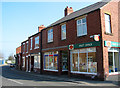
Post Office on Ramsay Street, High Spen
The village of High Spen is situated between Rowlands Gill and Greenside in County Durham.
Image: © Chris Tweedy
Taken: 29 Mar 2003
0.10 miles
2
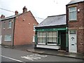
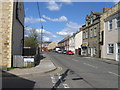
Adamson's Butchers, Ramsay Street, High Spen
High Spen was categorised as a "category D village" by Durham County Council. With the decline of coal-mining locally, 114 villages were classified in this way in 1951, and another seven in 1964. They were left to wither and die, without economic assistance or development. The policy ended in 1977, but many still have an old fashioned air, contrasting with newer areas of commuter housing.
Image: © Christine Johnstone
Taken: 12 Apr 2012
0.13 miles
4
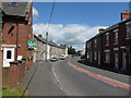
Ramsay Street, High Spen
High Spen was categorised as a "category D village" by Durham County Council. With the decline of coal-mining locally, 114 villages were classified in this way in 1951, and another seven in 1964. They were left to wither and die, without economic assistance or development. The policy ended in 1977, but many still have an old fashioned air, contrasting with newer areas of commuter housing.
Image: © Christine Johnstone
Taken: 12 Apr 2012
0.14 miles
5
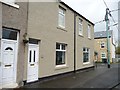
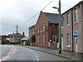
Houses on Front Street, High Spen
High Spen was categorised as a "category D village" by Durham County Council. With the decline of coal-mining locally, 114 villages were classified in this way in 1951, and another seven in 1964. They were left to wither and die, without economic assistance or development. The policy ended in 1977, and many of the pre-war houses have since had significant investment.
Image: © Christine Johnstone
Taken: 12 Apr 2012
0.14 miles
8
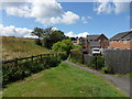
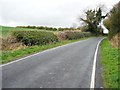
Brambles at the edge of farmland
On the north side of Ashtree Lane.
Image: © Christine Johnstone
Taken: 12 Apr 2012
0.16 miles
9
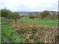
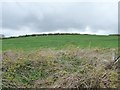
Farmland east of High Spen
Seen from Ashtree Lane.
Image: © Christine Johnstone
Taken: 12 Apr 2012
0.16 miles
10
Ivy-covered tree, Ashtree Lane
Looking northwest from the former waggonway level crossing.
Image: © Christine Johnstone
Taken: 12 Apr 2012
0.17 miles