
IMAGES TAKEN NEAR TO
Ashtree Lane, ROWLANDS GILL, NE39 2EA
Introduction
This page details the photographs taken nearby to Ashtree Lane, NE39 2EA by members of the Geograph project.
The Geograph project started in 2005 with the aim of publishing, organising and preserving representative images for every square kilometre of Great Britain, Ireland and the Isle of Man.

There are currently over 7.5m images from over14,400 individuals and you can help contribute to the project by visiting https://www.geograph.org.uk
Image Map
Images are licensed for reuse under creativecommons.org/licenses/by-sa/2.0
Notes
- Clicking on the map will re-center to the selected point.
- The higher the marker number, the further away the image location is from the centre of the postcode.
Image Listing (16 Images Found)
Images are licensed for reuse under creativecommons.org/licenses/by-sa/2.0
Image
Details
Distance
1
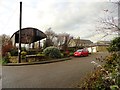
High Spen Court
This modern housing development on the east side of High Spen village, incorporates some old farm buildings.
Image: © Robert Graham
Taken: 12 Dec 2012
0.02 miles
3
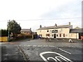
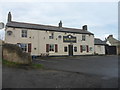
The Bute Arms, High Spen
Takes it name from the Marquess of Bute, a prominent nineteenth century coal owner.
Image: © Robert Graham
Taken: 12 Dec 2012
0.05 miles
5
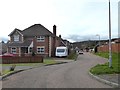
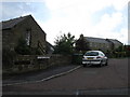
The Granaries, High Spen
Modern housing estate trying - not very convincingly - to connect with an agricultural past.
Image: © Oliver Dixon
Taken: 21 Mar 2019
0.08 miles
6
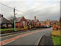
Village school
On Hookergate Lane in High Spen.
Image: © Robert Graham
Taken: 12 Dec 2012
0.11 miles
7
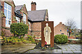
Memorial at High Spen
An unusual memorial outside the primary school at High Spen. It commemorates two solders awarded VCs in WW1 - William Dobson and Thomas Young. There are blue plaques on the nearby wall.
The monument consists of a rusted iron panel cut with the shape of a soldier in battle dress beyond which is a stone slab inscribed with the names of the two soldiers. A short length of rail track connects the iron and stone as if the first is a mine entrance; both soldiers were coal miners and both survived the war.
Image: © Trevor Littlewood
Taken: 20 Dec 2020
0.11 miles
8
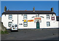
The Bute Arms
On the main road through High Spen in County Durham
Image: © Chris Tweedy
Taken: 29 Mar 2003
0.15 miles
9
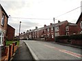
Hugar Road, High Spen
Typical nineteenth century terraced houses in this old mining village.
Image: © Robert Graham
Taken: 12 Dec 2012
0.16 miles
10
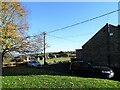
Looking south from Glossop Street
At the northern end of the village of High Spen.
Image: © Robert Graham
Taken: 22 Nov 2021
0.17 miles