IMAGES TAKEN NEAR TO
Stockley Road, WASHINGTON, NE38 8DP
Introduction
This page details the photographs taken nearby to Stockley Road, NE38 8DP by members of the Geograph project.
The Geograph project started in 2005 with the aim of publishing, organising and preserving representative images for every square kilometre of Great Britain, Ireland and the Isle of Man.

There are currently over 7.5m images from over14,400 individuals and you can help contribute to the project by visiting https://www.geograph.org.uk
Image Map
Images are licensed for reuse under creativecommons.org/licenses/by-sa/2.0
Notes
- Clicking on the map will re-center to the selected point.
- The higher the marker number, the further away the image location is from the centre of the postcode.
Image Listing (4 Images Found)
Images are licensed for reuse under creativecommons.org/licenses/by-sa/2.0
Image
Details
Distance
1
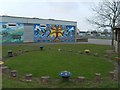
Barmston Primary School
View from Westerhope Road.
Image: © Gordon Griffiths
Taken: 20 Apr 2008
0.17 miles
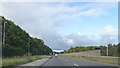
3
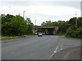
Spire Road passing under Sunderland Highway
Image: © Alexander P Kapp
Taken: 25 May 2011
0.22 miles
4

Garden
The formal garden at Washington Old Hall.
Image: © Chris McLean
Taken: 1 May 2005
0.23 miles