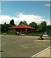
IMAGES TAKEN NEAR TO
Skaylock Drive, WASHINGTON, NE38 0QD

Introduction

This page details the photographs taken nearby to Skaylock Drive, NE38 0QD by members of the Geograph project.

The Geograph project started in 2005 with the aim of publishing, organising and preserving representative images for every square kilometre of Great Britain, Ireland and the Isle of Man.

There are currently over 7.5m images from over14,400 individuals and you can help contribute to the project by visiting https://www.geograph.org.uk

Image Map


Images are licensed for reuse under creativecommons.org/licenses/by-sa/2.0
Notes
  • Clicking on the map will re-center to the selected point.
  • The higher the marker number, the further away the image location is from the centre of the postcode.

Image Listing (6 Images Found)

Images are licensed for reuse under creativecommons.org/licenses/by-sa/2.0
Image
Details
Distance
1
Monkside Close, Lambton
Image: © Alex McGregor Taken: 2 Feb 2011
0.06 miles
2
The Cherry Tree, Lambton
Image: © Alex McGregor Taken: 2 Feb 2011
0.08 miles
3
Helvellyn Avenue, Lambton
Image: © Alex McGregor Taken: 2 Feb 2011
0.21 miles
4
Lambton Primary School, Lambton
Image: © Alex McGregor Taken: 30 Jun 2011
0.22 miles
5
Commemorative stone in Holley Park
It is now almost impossible to decipher the inscription on this stone, but it commemorates the work of Mr Holley, one of the leading figures in the creation of Washington New Town.
Image: © Oliver Dixon Taken: 31 May 2021
0.23 miles
6
Ayton Road, Washington
One of the feeder roads of the new town, of which the residential streets are accessed. To the right, one of the many paths which provide pedestrian access to the estates.
Image: © Oliver Dixon Taken: 31 May 2021
0.23 miles