IMAGES TAKEN NEAR TO
Sanderling Way, WASHINGTON, NE38 0AY
Introduction
This page details the photographs taken nearby to Sanderling Way, NE38 0AY by members of the Geograph project.
The Geograph project started in 2005 with the aim of publishing, organising and preserving representative images for every square kilometre of Great Britain, Ireland and the Isle of Man.

There are currently over 7.5m images from over14,400 individuals and you can help contribute to the project by visiting https://www.geograph.org.uk
Image Map
Images are licensed for reuse under creativecommons.org/licenses/by-sa/2.0
Notes
- Clicking on the map will re-center to the selected point.
- The higher the marker number, the further away the image location is from the centre of the postcode.
Image Listing (15 Images Found)
Images are licensed for reuse under creativecommons.org/licenses/by-sa/2.0
Image
Details
Distance
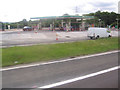
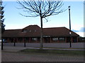
1
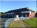
Travelodge, Washington Birtley southbound A1M services
Image: © JThomas
Taken: 25 Oct 2010
0.19 miles
2
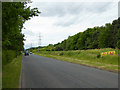
Crowther Road, Washington
A road flanking the western edge of Washington. Further north, the road is occupied by industrial premises; this section is ripe for development. The Washington Service area on the A1(M) llies to the right of the belt of trees.
Image: © Oliver Dixon
Taken: 19 Jun 2015
0.20 miles
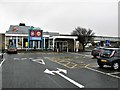
3
The Travelodge at Washington Services Area
In Northumberland.
Image: © James Denham
Taken: 11 May 2012
0.20 miles
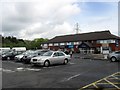
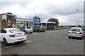
5
Washington Birtley Services, A1(M)
The southbound Washington Birtley Service Area on the A1(M) between junctions 65 and 64.
Image: © G Laird
Taken: 18 Oct 2017
0.22 miles
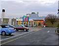
6
Washington Services
The southbound services on the A1(M).
Image: © DS Pugh
Taken: 6 Sep 2014
0.22 miles
7
Moto Washington Birtley southbound A1M services
Image: © Steve Fareham
Taken: 14 Nov 2007
0.22 miles
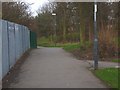
9

Ayton Road, Washington
One of the feeder roads of the new town, of which the residential streets are accessed. To the right, one of the many paths which provide pedestrian access to the estates.
Image: © Oliver Dixon
Taken: 31 May 2021
0.23 miles