IMAGES TAKEN NEAR TO
Nene Court, WASHINGTON, NE37 3LG
Introduction
This page details the photographs taken nearby to Nene Court, NE37 3LG by members of the Geograph project.
The Geograph project started in 2005 with the aim of publishing, organising and preserving representative images for every square kilometre of Great Britain, Ireland and the Isle of Man.

There are currently over 7.5m images from over14,400 individuals and you can help contribute to the project by visiting https://www.geograph.org.uk
Image Map
Images are licensed for reuse under creativecommons.org/licenses/by-sa/2.0
Notes
- Clicking on the map will re-center to the selected point.
- The higher the marker number, the further away the image location is from the centre of the postcode.
Image Listing (13 Images Found)
Images are licensed for reuse under creativecommons.org/licenses/by-sa/2.0
Image
Details
Distance
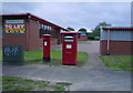
3
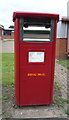
Royal Mail business box on Tower Road, Washington
Image: © JThomas
Taken: 18 Aug 2018
0.09 miles
4
Business unit on Tower Road, Washington
Showing position of Postbox No. NE37 741 and business box No. NE37 740.
See Image] for postbox.
See Image] for business box.
Image: © JThomas
Taken: 18 Aug 2018
0.09 miles
5
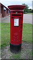
Elizabeth II postbox on Tower Road, Washington
Image: © JThomas
Taken: 18 Aug 2018
0.09 miles
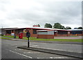
6
Elizabeth II postboxes on Tower Road, Washington
Postbox No. NE37 741 and business box No. NE37 740.
See Image] for postbox.
See Image] for business box.
Image: © JThomas
Taken: 18 Aug 2018
0.09 miles
7
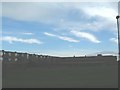
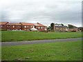
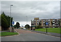
Sulgrave housing
The usual new town style of housing... brick and concrete flats dominate the area around here.
Image: © Steve McShane
Taken: 5 Nov 2005
0.11 miles
8
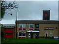
Concord / Washington Fire Station
The station was built in 1971 Hollinhill Road to increase the presence of the Fire Brigade as Washington rapidly expanded in the late 1960s. The main patrol area covers several Local Council Wards: Washington Central, Washington South, Washington West, Washington North/Houghton and Washington East/Gateshead.
Image: © Steve McShane
Taken: 5 Nov 2005
0.11 miles
9
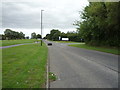
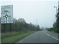
Glover Road, Washington
Looking east on the A1290.
Image: © JThomas
Taken: 18 Aug 2018
0.11 miles
10
Marlborough Road, Sulgrave, Washington
Buses and cyclists only - looking east.
Image: © JThomas
Taken: 18 Aug 2018
0.22 miles