IMAGES TAKEN NEAR TO
Craggyknowe, WASHINGTON, NE37 1JZ
Introduction
This page details the photographs taken nearby to Craggyknowe, NE37 1JZ by members of the Geograph project.
The Geograph project started in 2005 with the aim of publishing, organising and preserving representative images for every square kilometre of Great Britain, Ireland and the Isle of Man.

There are currently over 7.5m images from over14,400 individuals and you can help contribute to the project by visiting https://www.geograph.org.uk
Image Map
Images are licensed for reuse under creativecommons.org/licenses/by-sa/2.0
Notes
- Clicking on the map will re-center to the selected point.
- The higher the marker number, the further away the image location is from the centre of the postcode.
Image Listing (10 Images Found)
Images are licensed for reuse under creativecommons.org/licenses/by-sa/2.0
Image
Details
Distance
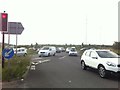
1
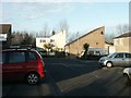
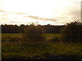
Westernmoor, Blackfell, Washington
Looking north.
Image: © Martin Wilson
Taken: 21 Jan 2006
0.05 miles
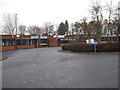
5
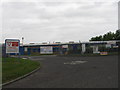
The Mill Inn. Springwell
Good food and live music.
Image: © Ann Hodgson
Taken: 30 Apr 2005
0.20 miles
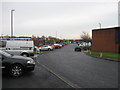
6
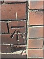
Ordnance Survey Cut Mark
This mark can be found on the roadside wall of the Mill House Inn.
The recorded details give a height of 121.1838 metres above sea level.
For more detail see : https://www.bench-marks.org.uk/bm174641
Image: © Peter Wood
Taken: 13 Aug 2022
0.20 miles
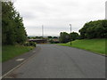
10
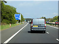
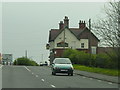
A194(M) at Junction 1 (A182 to Washington)
Image: © David Dixon
Taken: 29 Apr 2019
0.24 miles