IMAGES TAKEN NEAR TO
Bridle Path, EAST BOLDON, NE36 0PE
Introduction
This page details the photographs taken nearby to Bridle Path, NE36 0PE by members of the Geograph project.
The Geograph project started in 2005 with the aim of publishing, organising and preserving representative images for every square kilometre of Great Britain, Ireland and the Isle of Man.

There are currently over 7.5m images from over14,400 individuals and you can help contribute to the project by visiting https://www.geograph.org.uk
Image Map
Images are licensed for reuse under creativecommons.org/licenses/by-sa/2.0
Notes
- Clicking on the map will re-center to the selected point.
- The higher the marker number, the further away the image location is from the centre of the postcode.
Image Listing (13 Images Found)
Images are licensed for reuse under creativecommons.org/licenses/by-sa/2.0
Image
Details
Distance
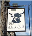
2
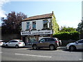
The Black Bull, East Boldon
On Front Street.
Image: © JThomas
Taken: 7 Jul 2018
0.13 miles
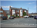
5
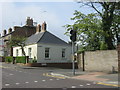
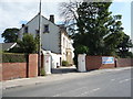
The Cottage in Western Terrace at East Boldon
Image: © Peter Robinson
Taken: 6 May 2012
0.14 miles
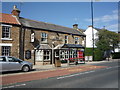
7
Boldon Convenience Store and Post Office
On Front Street.
Image: © JThomas
Taken: 7 Jul 2018
0.15 miles
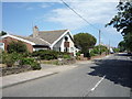
8
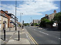
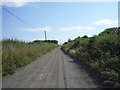
Front Street, East Boldon
Looking south east on the A184.
Image: © JThomas
Taken: 7 Jul 2018
0.18 miles
10
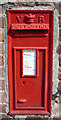
Victorian postbox on Dipe Lane, West Boldon
Postbox No. NE36 194.
See Image] for context.
Image: © JThomas
Taken: 7 Jul 2018
0.20 miles