
IMAGES TAKEN NEAR TO
Ridley Grove, SOUTH SHIELDS, NE34 6RN
Introduction
This page details the photographs taken nearby to Ridley Grove, NE34 6RN by members of the Geograph project.
The Geograph project started in 2005 with the aim of publishing, organising and preserving representative images for every square kilometre of Great Britain, Ireland and the Isle of Man.

There are currently over 7.5m images from over14,400 individuals and you can help contribute to the project by visiting https://www.geograph.org.uk
Image Map
Images are licensed for reuse under creativecommons.org/licenses/by-sa/2.0
Notes
- Clicking on the map will re-center to the selected point.
- The higher the marker number, the further away the image location is from the centre of the postcode.
Image Listing (15 Images Found)
Images are licensed for reuse under creativecommons.org/licenses/by-sa/2.0
Image
Details
Distance
1
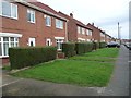
Houses on the north side of Felton Avenue
With front gardens set back slightly from the pavement.
Image: © Christine Johnstone
Taken: 25 Feb 2017
0.09 miles
2
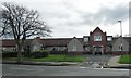
Entrance to Aged Miners' Homes, Marsden Road
Aged miners’ homes were some of the earliest forms of social housing to help elderly members of mining communities. These opened in 1915, and had indoor toilets when they were built, a real commitment to high quality care. Run by the Durham Aged Miners’ Homes Association..
Image: © Christine Johnstone
Taken: 25 Feb 2017
0.10 miles
3
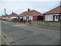
Bungalows in Summerhill Road
On the east side, backing onto the Aged Miners' Homes.
Image: © Christine Johnstone
Taken: 25 Feb 2017
0.11 miles
4
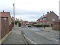
Junction of Fenton Avenue and Barbour Avenue
Looking eastwards.
Image: © Christine Johnstone
Taken: 25 Feb 2017
0.12 miles
5
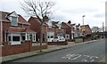
Housing on Harton Rise
Houses or dormer bungalows?
Image: © Christine Johnstone
Taken: 25 Feb 2017
0.13 miles
6
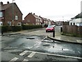
Barbour Avenue
Looking south from the junction with Fenton Avenue.
Image: © Christine Johnstone
Taken: 25 Feb 2017
0.13 miles
7
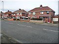
Houses in Summerhill Road
Running south from Marsden Road.
Image: © Christine Johnstone
Taken: 25 Feb 2017
0.14 miles
8
![Public footpath from Fenton Avenue to Bywell Avenue [2]](https://s0.geograph.org.uk/geophotos/05/30/05/5300584_269adcc0_120x120.jpg)
Public footpath from Fenton Avenue to Bywell Avenue [2]
The houses are in Bywell Avenue.
Image: © Christine Johnstone
Taken: 25 Feb 2017
0.16 miles
9
![Public footpath from Fenton Avenue to Bywell Avenue [1]](https://s2.geograph.org.uk/geophotos/05/30/05/5300582_ca5631cd_120x120.jpg)
Public footpath from Fenton Avenue to Bywell Avenue [1]
Strong garden fences, with the graffiti painted out.
Image: © Christine Johnstone
Taken: 25 Feb 2017
0.17 miles
10
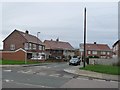
Barbour Avenue
On the west side of Centenary Avenue.
Image: © Christine Johnstone
Taken: 25 Feb 2017
0.18 miles