
IMAGES TAKEN NEAR TO
Cauldwell Avenue, SOUTH SHIELDS, NE34 0SD
Introduction
This page details the photographs taken nearby to Cauldwell Avenue, NE34 0SD by members of the Geograph project.
The Geograph project started in 2005 with the aim of publishing, organising and preserving representative images for every square kilometre of Great Britain, Ireland and the Isle of Man.

There are currently over 7.5m images from over14,400 individuals and you can help contribute to the project by visiting https://www.geograph.org.uk
Image Map
Images are licensed for reuse under creativecommons.org/licenses/by-sa/2.0
Notes
- Clicking on the map will re-center to the selected point.
- The higher the marker number, the further away the image location is from the centre of the postcode.
Image Listing (9 Images Found)
Images are licensed for reuse under creativecommons.org/licenses/by-sa/2.0
Image
Details
Distance
1
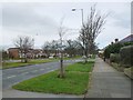
Newer houses off King George Road
The vehicle access is from the parallel Cauldwell Place.
Image: © Christine Johnstone
Taken: 25 Feb 2017
0.10 miles
2
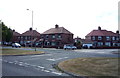
Houses on King George Road, South Shields
At the junction with Page Avenue.
Image: © JThomas
Taken: 7 Jul 2018
0.13 miles
3
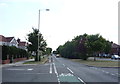
King George Road, South Shields
Looking south on the A1018.
Image: © JThomas
Taken: 7 Jul 2018
0.14 miles
4
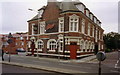
The County, Sunderland Road, Westoe
The County pub seen from across the A19 Sunderland Road in 1993. I spent far too long slurping nasty keg Scotch Ale in here in 1979 when I should have been studying. In fact in all my time at college I don't think I missed a night there, and still managed to pass my ticket!
When I dropped in in 1993 the cosy little private bar that had been my haunt was locked up, but at least they had some decent beer on by then.
Image: © Stephen Williams
Taken: 28 Sep 1993
0.17 miles
5
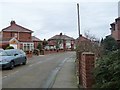
Stanton Avenue, looking north-east
Curving between Mortimer Road and King George Road.
Image: © Christine Johnstone
Taken: 25 Feb 2017
0.18 miles
6
![Central reservation, King George Road [A1018]](https://s1.geograph.org.uk/geophotos/05/30/04/5300417_db79c059_120x120.jpg)
Central reservation, King George Road [A1018]
Looking northwards. Given the name and the design, this was probably built in the 1930s.
Image: © Christine Johnstone
Taken: 25 Feb 2017
0.18 miles
7
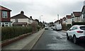
Harton Grove
Running south from Holmfield Avenue.
Image: © Christine Johnstone
Taken: 25 Feb 2017
0.19 miles
8
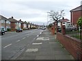
Southbound bus stop on Mortimer Road
Between Stanton Avenue and Ambleside Avenue.
Image: © Christine Johnstone
Taken: 25 Feb 2017
0.22 miles
9
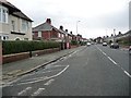
Southbound bus stop on Sunderland Road
Looking south-east from the junction Harton House Road.
Image: © Christine Johnstone
Taken: 25 Feb 2017
0.24 miles