
IMAGES TAKEN NEAR TO
Hudson Street, SOUTH SHIELDS, NE34 0AE
Introduction
This page details the photographs taken nearby to Hudson Street, NE34 0AE by members of the Geograph project.
The Geograph project started in 2005 with the aim of publishing, organising and preserving representative images for every square kilometre of Great Britain, Ireland and the Isle of Man.

There are currently over 7.5m images from over14,400 individuals and you can help contribute to the project by visiting https://www.geograph.org.uk
Image Map
Images are licensed for reuse under creativecommons.org/licenses/by-sa/2.0
Notes
- Clicking on the map will re-center to the selected point.
- The higher the marker number, the further away the image location is from the centre of the postcode.
Image Listing (48 Images Found)
Images are licensed for reuse under creativecommons.org/licenses/by-sa/2.0
Image
Details
Distance
1
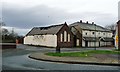
Derelict bingo hall, Hudson Street
Crown Bingo opened here on 14th August 1961, according to the signwriting. The brick building had been a school, as there is a 'Boys' sign carved over the door.
Image: © Christine Johnstone
Taken: 25 Feb 2017
0.08 miles
2
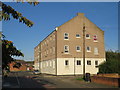
Lord Nelson Street, near South Shields
Shaftesbury House on Lord Nelson Street, on the outskirts of South Shields.
Image: © Malc McDonald
Taken: 20 Sep 2019
0.10 miles
3
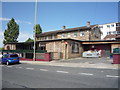
Man Vs Food Grill House, South Shields
On Hudson Street.
Image: © JThomas
Taken: 7 Jul 2018
0.10 miles
5
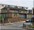
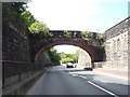
The Dock
The Dock public house at Tyne Dock in South Shields.
Image: © Peter McDermott
Taken: 19 Jun 2011
0.11 miles
6
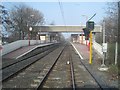
Tyne Dock Metro station, Tyne & Wear
Opened in 1984 by the Tyne & Wear Metro on the line from Pelaw to South Shields, although the line on which it stands was built by the Stanhope & Tyne Railway in 1834.
View north east towards Chichester and South Shields. An earlier station, also called Tyne Dock was situated just out of view to the left on the adjacent Brandling Junction Railway route to South Shields via High Shields until 1981.
Image: © Nigel Thompson
Taken: 24 Mar 2012
0.11 miles
7
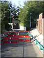
Cycle barriers, Tyne Dock Station
These barriers have been erected to discourage cyclists from riding through the subway or up the ramps to Tyne Dock Station - all part of the anti-cycling ethos of the Tyne and Wear Metro.
Image: © Oliver Dixon
Taken: 30 Sep 2015
0.11 miles
8
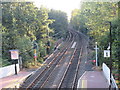
Tyne & Wear Metro at Tyne Dock
Tyne & Wear Metro tracks heading out of Tyne Dock station. This view looks south-westwards.
Image: © Malc McDonald
Taken: 20 Sep 2019
0.11 miles
9
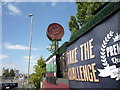
Sign for the Man Vs Food Grill House, South Shields
Image: © JThomas
Taken: 7 Jul 2018
0.11 miles
10
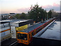
Tyne Dock Metro Station
The train to South Shields pulls out of surely the scruffiest station on a system which prides itself on the cleanliness of its stations. Aren't the people of South Shields and the Tyne and Wear Metro ashamed enough to do something about it?
Image: © Alan Fearon
Taken: 18 Nov 2005
0.11 miles