
IMAGES TAKEN NEAR TO
Concorde Way, JARROW, NE32 5BB
Introduction
This page details the photographs taken nearby to Concorde Way, NE32 5BB by members of the Geograph project.
The Geograph project started in 2005 with the aim of publishing, organising and preserving representative images for every square kilometre of Great Britain, Ireland and the Isle of Man.

There are currently over 7.5m images from over14,400 individuals and you can help contribute to the project by visiting https://www.geograph.org.uk
Image Map
Images are licensed for reuse under creativecommons.org/licenses/by-sa/2.0
Notes
- Clicking on the map will re-center to the selected point.
- The higher the marker number, the further away the image location is from the centre of the postcode.
Image Listing (153 Images Found)
Images are licensed for reuse under creativecommons.org/licenses/by-sa/2.0
Image
Details
Distance
1
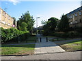
Wuppertal Court in Jarrow
Wuppertal Court in Jarrow which was previously part of Albert Road and Bridge Street
Railway Bridge still runs across it
Image: © Vin Mullen
Taken: 25 Apr 2007
0.03 miles
2
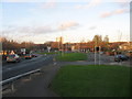
Monkton Terrace in Jarrow
Monkton Terrace in Jarrow.
Viewed from the railway bridge.
In the distance the highrise flats Wilkinson Court and Monastery Court
Image: © Vin Mullen
Taken: 27 Nov 2009
0.06 miles
3
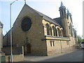
St. Bede's RC Church in Jarrow
St. Bede's RC Church in Jarrow
It is viewed from St. Johns Terrace
Image: © Vin Mullen
Taken: 29 Mar 2007
0.07 miles
5
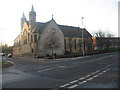
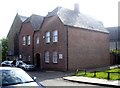
St. Bede's RC Church in Jarrow
St.Bede's RC Church in Jarrow has been around since 1861
This picture is viewed from Monkton Road
To the left on the picture is St.Johns Terrace
To the right is Morrison's Supermarket
In front of the church along Monkton Road was attached a school St.Bede's RC Infants which was demolished in the late 1960s
Image: © Vin Mullen
Taken: 27 Nov 2009
0.08 miles
6
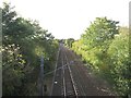
Railway lines east of Jarrow Metro Station
Looking along the railway tracks from the bridge which carries Monkton Terrace over the lines. The line on the left is used by Tyne and Wear Metro trains going to and from South Shields, the line on the right is used by freight trains accessing the sidings of the nearby oil terminal.
Image: © Graham Robson
Taken: 7 Oct 2017
0.08 miles
7
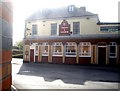
Crown and Anchor, Jarrow
A community pub.
Image: © Stanley Howe
Taken: 16 Apr 2011
0.08 miles
8
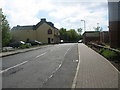
Chapel Road in Jarrow
Chapel Road in Jarrow looking West
To the left of the picture, the Crown and Anchor Public House and car Park
To the right of the picture, the outer walls of Morrisons Supermarket
Image: © Vin Mullen
Taken: 1 Apr 2007
0.09 miles
9
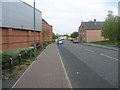
Chapel Road in Jarrow
Chapel Road in Jarrow looking east.
To the left of the picture the outer walls of Morrisons Supermarket.
To the centre Morrisons Supermarket Garage and car park.
To the right the Presbytery of St. Bede's RC Church.
Image: © Vin Mullen
Taken: 1 Apr 2007
0.09 miles
10
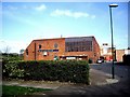
Ellison Social Club, Jarrow
From the car park.
Image: © Stanley Howe
Taken: 16 Apr 2011
0.09 miles