IMAGES TAKEN NEAR TO
Canterbury Way, JARROW, NE32 4TD
Introduction
This page details the photographs taken nearby to Canterbury Way, NE32 4TD by members of the Geograph project.
The Geograph project started in 2005 with the aim of publishing, organising and preserving representative images for every square kilometre of Great Britain, Ireland and the Isle of Man.

There are currently over 7.5m images from over14,400 individuals and you can help contribute to the project by visiting https://www.geograph.org.uk
Image Map (Loading...)


Getting Data...Please wait
Leaflet Map data © OpenStreetMap
Images are licensed for reuse under creativecommons.org/licenses/by-sa/2.0
Notes
- Clicking on the map will re-center to the selected point.
- The higher the marker number, the further away the image location is from the centre of the postcode.
Image Listing (15 Images Found)
Images are licensed for reuse under creativecommons.org/licenses/by-sa/2.0
Image
Details
Distance
1
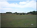
Grazing, Fellgate
Looking north from Leam Lane towards the railway from Newcastle to Sunderland.
Image: © JThomas
Taken: 7 Jul 2018
0.11 miles
2
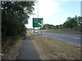
Path beside Leam Lane (A194)
Looking north east.
Image: © JThomas
Taken: 7 Jul 2018
0.13 miles
3
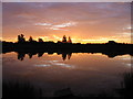
Sunrise over the Lakeside fishery, 6:32am
Image: © P Glenwright
Taken: 5 Sep 2004
0.15 miles
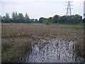
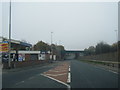
5

Leam Lane (A194) at Monckton Fell
Looking north-eastward in the direction of South Shields.
Image: © Peter Wood
Taken: 23 Mar 2019
0.16 miles
6
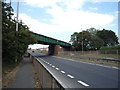
Railway bridge over Leam Lane (A194)
Looking north east.
Image: © JThomas
Taken: 7 Jul 2018
0.17 miles
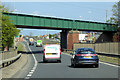
8
A194 Leam Lane at Primrose railway bridge
Image: © Colin Pyle
Taken: 3 Nov 2015
0.18 miles
9
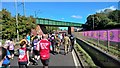
Catching up with the riot police
On the Great North Run, about to pass under the Metro, a mode of transport that was proving somewhat I inadequate to meet demand on this day.
Image: © Chris Morgan
Taken: 13 Sep 2015
0.18 miles
10
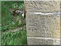
Ordnance Survey Cut Mark
This mark can be found on the roadside wall of The Lakeside PH. The benchmark height is recorded as being 35.439 metres above sea level.
For more detail see : https://www.bench-marks.org.uk/bm105766
Image: © Peter Wood
Taken: 23 Mar 2019
0.20 miles