IMAGES TAKEN NEAR TO
Fieldway, JARROW, NE32 4QH
Introduction
This page details the photographs taken nearby to Fieldway, NE32 4QH by members of the Geograph project.
The Geograph project started in 2005 with the aim of publishing, organising and preserving representative images for every square kilometre of Great Britain, Ireland and the Isle of Man.

There are currently over 7.5m images from over14,400 individuals and you can help contribute to the project by visiting https://www.geograph.org.uk
Image Map
Images are licensed for reuse under creativecommons.org/licenses/by-sa/2.0
Notes
- Clicking on the map will re-center to the selected point.
- The higher the marker number, the further away the image location is from the centre of the postcode.
Image Listing (10 Images Found)
Images are licensed for reuse under creativecommons.org/licenses/by-sa/2.0
Image
Details
Distance
1
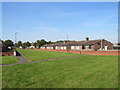
Bungalows at Hedworth, near Jarrow
Bungalows on a housing estate at Hedworth, near Jarrow.
Image: © Malc McDonald
Taken: 20 Sep 2019
0.14 miles
2
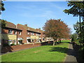
Housing at Hedworth, near Jarrow
A housing estate at Hedworth, near Jarrow.
Image: © Malc McDonald
Taken: 20 Sep 2019
0.17 miles
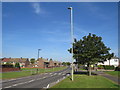
4
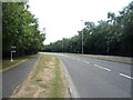
Abingdon Way, Boldon Colliery
Looking south east.
Image: © JThomas
Taken: 7 Jul 2018
0.19 miles
5
Fellgate Avenue, Hedworth, near Jarrow
Fellgate Avenue in Hedworth, near Jarrow.
Image: © Malc McDonald
Taken: 20 Sep 2019
0.20 miles
6
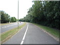
Cycle path beside Abingdon Way, Boldon Colliery
Looking south east.
Image: © JThomas
Taken: 7 Jul 2018
0.21 miles
7
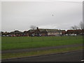
Hedworth Lane Primary School, Boldon Colliery
Image: © Les Hull
Taken: 11 Feb 2010
0.22 miles
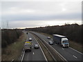
8

Traffic Cameras on the A19 near to Boldon Colliery
Image: © David Dixon
Taken: 21 May 2021
0.23 miles
9
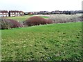
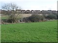
The route of Calfclose Beck, separating two estates
Looking eastwards from Fellgate's Durham Dive to Hedworth's Field Way.
Image: © Christine Johnstone
Taken: 25 Feb 2017
0.24 miles
10
Bridge across Calfclose Beck
The houses in the distance are in Cedworth's Cedar Drive.
Image: © Christine Johnstone
Taken: 25 Feb 2017
0.24 miles