IMAGES TAKEN NEAR TO
Iona Road, JARROW, NE32 4JP
Introduction
This page details the photographs taken nearby to Iona Road, NE32 4JP by members of the Geograph project.
The Geograph project started in 2005 with the aim of publishing, organising and preserving representative images for every square kilometre of Great Britain, Ireland and the Isle of Man.

There are currently over 7.5m images from over14,400 individuals and you can help contribute to the project by visiting https://www.geograph.org.uk
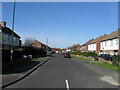
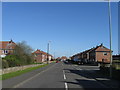
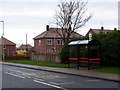
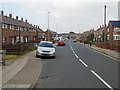
Image Map
Images are licensed for reuse under creativecommons.org/licenses/by-sa/2.0
Notes
- Clicking on the map will re-center to the selected point.
- The higher the marker number, the further away the image location is from the centre of the postcode.
Image Listing (14 Images Found)
Images are licensed for reuse under creativecommons.org/licenses/by-sa/2.0
Image
Details
Distance
5
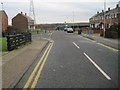
Brisbane Avenue, looking towards Brockley Whins Metro station
Image: © Nigel Thompson
Taken: 18 Jan 2017
0.14 miles
7
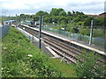
Brockley Whins Metro / Boldon Colliery railway station, Tyne & Wear
Opened in 1844 as Brockley Whins by the Brandling Junction Railway, later to become part of the North Eastern Railway, on the line from Newcastle to Sunderland. The station was known as Boldon Colliery between 1925 and 1991. It was rebuilt and transferred to Metro operation in 2002.
View north west towards Fellgate and Newcastle.
Image: © Nigel Thompson
Taken: 7 Jun 2009
0.17 miles
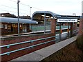
8
Brockley Whins Metro station
A southbound train for Sunderland and South Hylton is departing
Image: © Graham Hogg
Taken: 21 Nov 2012
0.18 miles
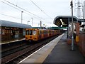
9
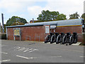
Brockley Whins Metro Station
Cycle racks outside the station. The notice board to the left describes the Linnet Way, a walk through the Great North Forest which starts from here and goes through to the coast at Marsden.
Image: © Oliver Dixon
Taken: 30 Sep 2015
0.18 miles
10
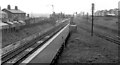
Boldon Colliery Station
View eastward, towards Sunderland and Tyne Dock; ex-NER Newcastle - Sunderland - West Hartlepool - Stockton secondary main line, junction of line to Tyne Dock. Called 'Brockley Whins' until 1926, it regained that name on 30/9/91. On 31/3/02 it was rebuilt and taken over by the Tyne & Wear Metro when the latter extended to Sunderland.
Image: © Ben Brooksbank
Taken: 12 May 1965
0.18 miles