IMAGES TAKEN NEAR TO
Iona Road, JARROW, NE32 4JA
Introduction
This page details the photographs taken nearby to Iona Road, NE32 4JA by members of the Geograph project.
The Geograph project started in 2005 with the aim of publishing, organising and preserving representative images for every square kilometre of Great Britain, Ireland and the Isle of Man.

There are currently over 7.5m images from over14,400 individuals and you can help contribute to the project by visiting https://www.geograph.org.uk
Image Map
Images are licensed for reuse under creativecommons.org/licenses/by-sa/2.0
Notes
- Clicking on the map will re-center to the selected point.
- The higher the marker number, the further away the image location is from the centre of the postcode.
Image Listing (20 Images Found)
Images are licensed for reuse under creativecommons.org/licenses/by-sa/2.0
Image
Details
Distance
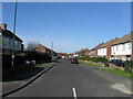
1
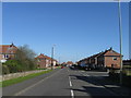
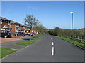
Station Road, West Boldon
The embankment on the left carries the Metro line. Brockley Whins station is just out of sight.
Image: © Oliver Dixon
Taken: 30 Sep 2015
0.14 miles
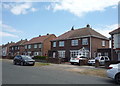
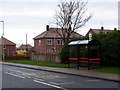
4
Arran Drive, Jarrow
Housing near the busy A19.
Image: © JThomas
Taken: 7 Jul 2018
0.18 miles
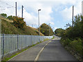
5
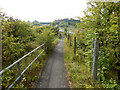
Path beside the A19
This well-hidden and little-used tarmac path drops down to run close to the A19 where it passes under the bridge carrying the Tyne and Wear Metro.
Image: © Oliver Dixon
Taken: 30 Sep 2015
0.20 miles
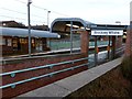
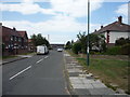
7
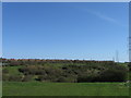
View NE from Station Road, Boldon Colliery
Image: © Alex McGregor
Taken: 22 Apr 2010
0.20 miles