IMAGES TAKEN NEAR TO
Bede Walk, HEBBURN, NE31 2SB
Introduction
This page details the photographs taken nearby to Bede Walk, NE31 2SB by members of the Geograph project.
The Geograph project started in 2005 with the aim of publishing, organising and preserving representative images for every square kilometre of Great Britain, Ireland and the Isle of Man.

There are currently over 7.5m images from over14,400 individuals and you can help contribute to the project by visiting https://www.geograph.org.uk
Image Map (Loading...)


Getting Data...Please wait
Leaflet Map data © OpenStreetMap
Images are licensed for reuse under creativecommons.org/licenses/by-sa/2.0
Notes
- Clicking on the map will re-center to the selected point.
- The higher the marker number, the further away the image location is from the centre of the postcode.
Image Listing (13 Images Found)
Images are licensed for reuse under creativecommons.org/licenses/by-sa/2.0
Image
Details
Distance
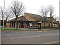
2
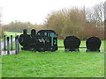
No 2 Coal Train, Entrance Campbell Park
Image: © Alex McGregor
Taken: 13 Apr 2010
0.15 miles
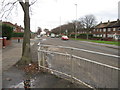
5
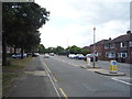
Victoria Road East, Hebburn
Looking south west.
Image: © JThomas
Taken: 7 Jul 2018
0.20 miles
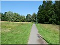
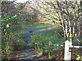
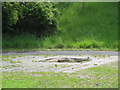
6
'Bede's Well' Jarrow
Bede's Well Jarrow looking west.
Image: © Vin Mullen
Taken: 26 Apr 2007
0.21 miles
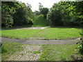
7
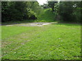
'Bede's Well' Jarrow
Bede's Well Jarrow looking west
Image: © Vin Mullen
Taken: 26 Apr 2007
0.21 miles
8
'Bede's Well' Jarrow
Bede's Well Jarrow looking west.
Image: © Vin Mullen
Taken: 26 Apr 2007
0.21 miles