
IMAGES TAKEN NEAR TO
Reed Street, NORTH SHIELDS, NE30 1DD
Introduction
This page details the photographs taken nearby to Reed Street, NE30 1DD by members of the Geograph project.
The Geograph project started in 2005 with the aim of publishing, organising and preserving representative images for every square kilometre of Great Britain, Ireland and the Isle of Man.

There are currently over 7.5m images from over14,400 individuals and you can help contribute to the project by visiting https://www.geograph.org.uk
Image Map
Images are licensed for reuse under creativecommons.org/licenses/by-sa/2.0
Notes
- Clicking on the map will re-center to the selected point.
- The higher the marker number, the further away the image location is from the centre of the postcode.
Image Listing (68 Images Found)
Images are licensed for reuse under creativecommons.org/licenses/by-sa/2.0
Image
Details
Distance
1

Blue Plaque, Site of Former Wilkinson's Lemonade Factory, George Street, North Shields
Wilkinson’s Lemonade Factory, North Shields was destroyed by a bomb from a lone German raider on the night of 2nd/3rd May 1941. The basement of the factory was being used as an air raid shelter that night by 192 people, 107 of whom were killed (men, women & children). This is believed to have been the largest single bomb loss of life, outside London, during the 1939-45 conflict.
Image: © Geoff Holland
Taken: 24 Jun 2025
0.06 miles
2

Blue Plaque, Site of Former Wilkinson’s Lemonade Factory, George Street, North Shields
Wilkinson’s Lemonade Factory, North Shields was destroyed by a bomb from a lone German raider on the night of 2nd/3rd May 1941. The basement of the factory was being used as an air raid shelter that night by 192 people, 107 of whom were killed (men, women & children). This is believed to have been the largest single bomb loss of life, outside London, during the 1939-45 conflict. In the immediate aftermath of the blast, Ellen Lee, an 6 foot tall, 18 stone Air Raid Precautions warden (ARP) in charge of the shelter, found the exit door blocked with fallen rubble. So, using her own strength and weight she shoulder-charged the wall repeatedly until it gave way sufficiently to make an opening out on to the street and, despite her own injuries, she manned the escape route until 32 people had managed to get out. Whilst two men received a George Medal and a third a British Empire Medal for their bravery that night, Ellen Lee received no official recognition for her undoubtedly brave actions. This grave oversight has now, to some extent, been rectified with the naming of recently built Ellen Lee Close in a prominent position overlooking the River Tyne https://www.geograph.org.uk/photo/8065394 and by the erection of this Blue Plaque in nearby George Street at the site of the former Wilkinson Lemonade Factory https://www.geograph.org.uk/photo/8081067.
Image: © Geoff Holland
Taken: 24 Jun 2025
0.06 miles
6
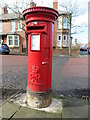
Post Box, Linskill Terrace, North Shields
This post box dates from the reign of Queen Elizabeth II and stands on Linskill Terrace close to Jackson Street. For a selection of detailed free to download walking routes in the area visit www.northtynesidewalks.co.uk
Image: © Geoff Holland
Taken: 16 Feb 2021
0.16 miles
7
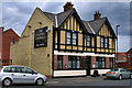
The Colonel Linskill
The Colonel Linskill public house.
Image: © Peter McDermott
Taken: 21 May 2011
0.16 miles
8

'Woven Voices' Artwork, Stephenson Street/Tynemouth Road, North Shields
This sculpture was created by Canadian visual artist and muralist Aaron Li-Hill who took inspiration from the resident's artworks and stories, born out of numerous workshops with local people, and from local dancers. The work represents the overwhelming spirit of togetherness and connectedness that the people who took part felt about North Shields. The commission is part of North Tyneside Council's 'An Ambition for North Shields' Masterplan.
Image: © Geoff Holland
Taken: 24 Jun 2025
0.17 miles
9

Former Memorial Church, Albion Road, North Shields
This is part of a group of buildings, which is Grade II Listed, consisting of the former Memorial Church, Sunday School and Minister's House which was built between 1889 and 1893. The four-light west window, seen here, has pink granite nook shafts whilst the three-stage tower has gargoyles to the pierced parapet. For a selection of detailed free to download walking routes in the area visit www.northtynesidewalks.co.uk
Image: © Geoff Holland
Taken: 16 Feb 2021
0.18 miles
10
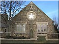
Former Sunday School, Memorial Church, Albion Road, North Shields
This is part of a group of buildings, which is Grade II Listed, consisting of the former Memorial Church, Sunday School and Minister's House which was built between 1889 and 1893. This handsome gable consists of a buttress between pairs of triple lancets under a cinquefoil window. For a selection of detailed free to download walking routes in the area visit www.northtynesidewalks.co.uk
Image: © Geoff Holland
Taken: 16 Feb 2021
0.18 miles