
IMAGES TAKEN NEAR TO
Lynn Road, NORTH SHIELDS, NE29 8LE
Introduction
This page details the photographs taken nearby to Lynn Road, NE29 8LE by members of the Geograph project.
The Geograph project started in 2005 with the aim of publishing, organising and preserving representative images for every square kilometre of Great Britain, Ireland and the Isle of Man.

There are currently over 7.5m images from over14,400 individuals and you can help contribute to the project by visiting https://www.geograph.org.uk
Image Map
Images are licensed for reuse under creativecommons.org/licenses/by-sa/2.0
Notes
- Clicking on the map will re-center to the selected point.
- The higher the marker number, the further away the image location is from the centre of the postcode.
Image Listing (10 Images Found)
Images are licensed for reuse under creativecommons.org/licenses/by-sa/2.0
Image
Details
Distance
1
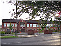
St Thomas More School, entrance
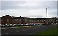
Established in 1988, the school faces the B1316, Billy Mill Lane. It is an 11-18 mixed comprehensive and specialist Maths and Computing school serving the Catholic population of North Tyneside. There are over 1700 pupils on roll, including more than 350 students post-16.
Image: © Richard Dorrell
Taken: 2 Aug 2011
0.02 miles
2
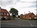
Cragside Avenue, Billy Mill
Residential road seen from its junction with the B1316 Billy Mill Lane.
Image: © Richard Dorrell
Taken: 2 Aug 2011
0.05 miles
3
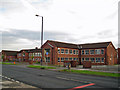
St Thomas More RC High School, Billy Mill
Established in 1988, the school faces the B1316, Billy Mill Lane. It is an 11-18 mixed comprehensive and specialist Maths and Computing school serving the Catholic population of North Tyneside. There are over 1700 pupils on roll, including more than 350 students post-16.
Image: © Richard Dorrell
Taken: 2 Aug 2011
0.05 miles
4
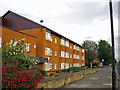
St Aidan's House, Billy Mill
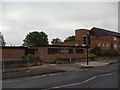
Located in Billy Mill Lane, St Aidan's House is a retirement home operated by Anchor Trust.
Image: © Richard Dorrell
Taken: 2 Aug 2011
0.08 miles
7
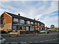
Shops in St Anselm Road, North Shields
Inferno (on the left) is a tanning parlour and beauty salon. After a session there, you can visit Canatrice the baker next door, or if in a hurry, pop into Bev's Light Bites next to the baker. The other two units are a One Stop convenience store and Oasis Hair Design studio.
Image: © Richard Dorrell
Taken: 2 Aug 2011
0.11 miles
8
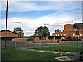
St Aidan's Church, Billy Mill
Located on the B1316, Billy Mill Lane, and with a church hall alongside. The church is in the parish of St. George, Cullercoats.
Image: © Richard Dorrell
Taken: 2 Aug 2011
0.11 miles
9
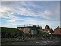
Building at Billy Mill reservoir
The reservoirs here are underground. The building pictured is in Whitehouse Lane, and is dated 1901.
Image: © Richard Dorrell
Taken: 2 Aug 2011
0.15 miles
10
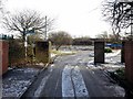
Derelict site off Morwick Road
Previously occupied by The Cedars Resource Centre, a residential care home. The two storey building was demolished and the site cleared at the end of 2017. There is another photo here Image
Image: © Andrew Curtis
Taken: 18 Jan 2018
0.24 miles