IMAGES TAKEN NEAR TO
Denton Avenue, NORTH SHIELDS, NE29 7EH
Introduction
This page details the photographs taken nearby to Denton Avenue, NE29 7EH by members of the Geograph project.
The Geograph project started in 2005 with the aim of publishing, organising and preserving representative images for every square kilometre of Great Britain, Ireland and the Isle of Man.

There are currently over 7.5m images from over14,400 individuals and you can help contribute to the project by visiting https://www.geograph.org.uk
Image Map
Images are licensed for reuse under creativecommons.org/licenses/by-sa/2.0
Notes
- Clicking on the map will re-center to the selected point.
- The higher the marker number, the further away the image location is from the centre of the postcode.
Image Listing (8 Images Found)
Images are licensed for reuse under creativecommons.org/licenses/by-sa/2.0
Image
Details
Distance
2
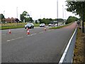
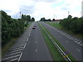
Slip road onto the Coast Road
Slip road from Norham Road on to the Coast Road, A1058.
Image: © Oliver Dixon
Taken: 5 Aug 2016
0.18 miles
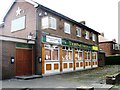
5
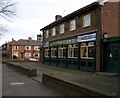
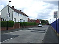
The Nautilus Pub, Chirton, North Shields
Image: © Alan Fearon
Taken: 15 Dec 2005
0.19 miles
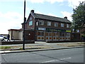
6
West Chirton Industrial Estate
View of West Chirton Industrial Estate seen from the North Tyneside Railway.
Image: © Peter McDermott
Taken: 21 May 2011
0.19 miles